Fire danger high in the Maritimes, record heat in Thursday's forecast
While firefighters were hoping for a break in the dry, windy weather, CTV meteorologist Kalin Mitchell says fire danger remains high over the next 24 hours.
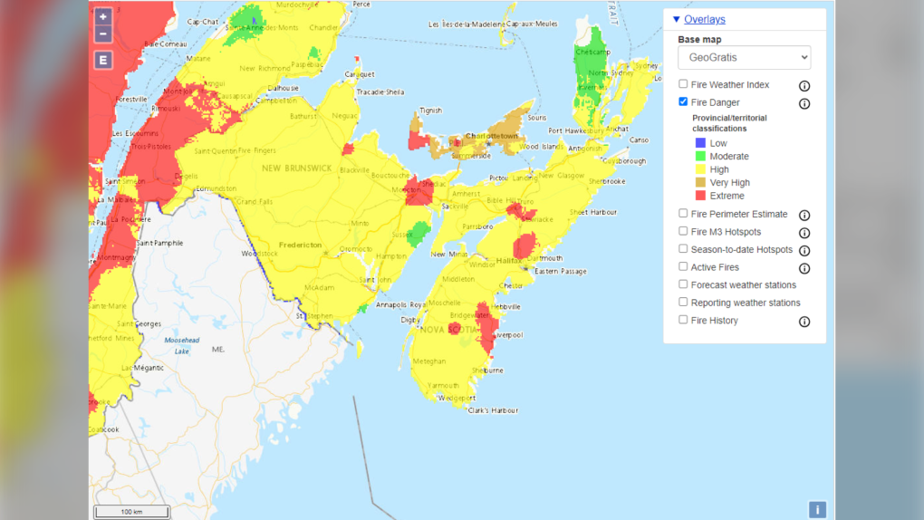 Fire danger remains high with pockets of very high to extreme for most of the Maritimes. That per Natural Resources Canada.
A gusty southwest wind, warmer temperatures, and dry air are all factoring into the wildfire battle Wednesday.
Wildfire smoke is still present in the vicinity of much of the Atlantic coastline of Nova Scotia. Reports of that smoke are varied, but areas that get into a haze could see air quality index values of seven or eight, which is considered high risk. Air Quality Statements remain in effect for the Atlantic coastal counties of mainland Nova Scotia. Near surface smoke models show smoke moving back inland late afternoon/evening, before a change to a westerly wind takes it back out over the ocean overnight.
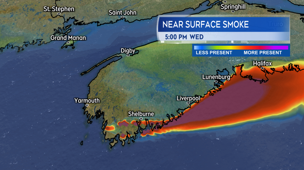 Near surface smoke is still expected to be present around the Atlantic coastline of Nova Scotia Wednesday afternoon into evening.
Temperatures for Thursday are expected to reach the high 20s and low 30s for much of the Maritimes. In some cases, record highs for a June 1 are likely to be met or exceeded. Standing record highs for New Brunswick for that date mostly range between 28 to 34 degrees, 27 to 33 degrees for Nova Scotia, and 26 to 30 for Prince Edward Island.
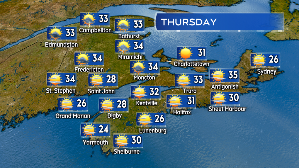 Sunny and hot on Thursday with a still drier brand of air in place. A risk of pop up thunderstorms in New Brunswick.
The hot weather comes with an increased risk of cross over conditions when it comes to the wildfires. Cross over conditions occur when temperature and humidity reach the same number, i.e. 30 degree temperature and 30 per cent relative humidity. Wind speed is sometimes taken into account as well. The occurrence of cross over conditions is closely associated with more extreme behaviour when it comes to wildfires.
There is little precipitation in the Maritime forecast Wednesday and Thursday. It is expected to be generally clear Wednesday night, with just a few high clouds and, for Nova Scotia, some haze from wildfire smoke present. Thursday may see some thunderstorms develop in New Brunswick late afternoon into evening. The rain coverage of those thunderstorms looks spotty at best.
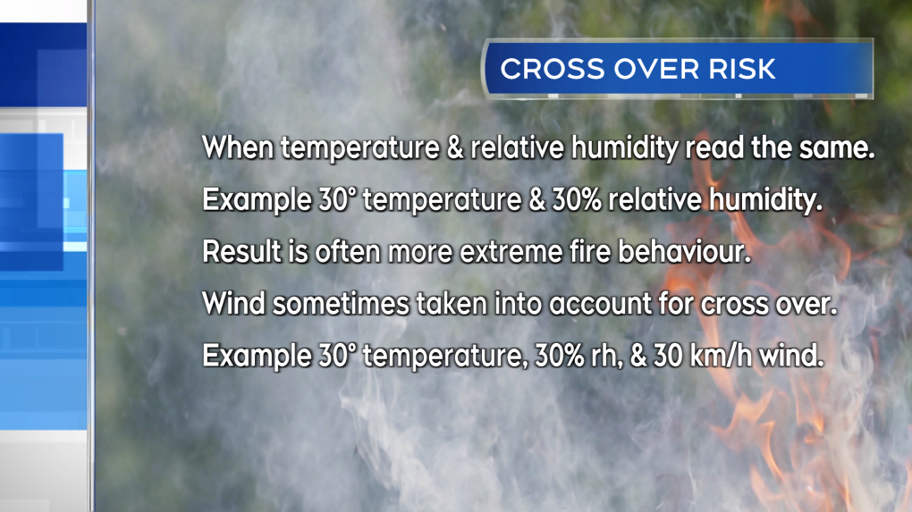 A particularly worrisome set of conditions when it comes to wild fires is a cross over. That is when temperature and relative humidity reach the same number.
Weather for combating wildfires is forecast to improve for Friday.
A cold front moving into the Maritimes out of Quebec will bring increased cloud cover, showers, and cool temperatures. While coverage of the showers looks scattered for Friday, the cooling temperatures and eventual turn to northerly winds will result in an overall increase to relative humidity. Additionally, there is a chance the front could stall in the vicinity of Nova Scotia Saturday. That would bring further periods of rain to that province to start the weekend with showers likely for New Brunswick and Prince Edward Island.
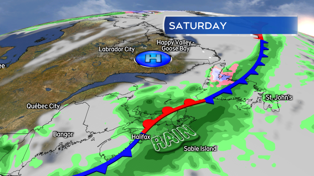 There is a chance the Friday weather front stalls over Nova Scotia for Saturday. That would be great as more rain would be expected.
In that scenario the prolonged period of wet weather would likely bring in a much needed 10+ mm of rain to large part of Nova Scotia. Some caution should be taken on locking in that forecast though. The lingering rain is a recent development in weather forecast models for the weekend. There remains a possibility that high pressure building from the west could push the front east over the Atlantic, taking the rain along with it.
CTVNews.ca Top Stories

How quietly promised law changes in the 2024 federal budget could impact your day-to-day life
The 2024 federal budget released last week includes numerous big spending promises that have garnered headlines. But, tucked into the 416-page document are also series of smaller items, such as promising to amend the law regarding infant formula and to force banks to label government rebates, that you may have missed.
Which foods have the most plastics? You may be surprised
'How much plastic will you have for dinner, sir? And you, ma'am?' While that may seem like a line from a satirical skit on Saturday Night Live, research is showing it's much too close to reality.
opinion I've been a criminal attorney for decades. Here's what I think about the case against Trump
Joey Jackson, a criminal defence attorney and a legal analyst for CNN, outlines what he thinks about the criminal case against Donald Trump in the 'hush money trial.'
$3.8M home in B.C.'s Okanagan has steel shell for extra wildfire protection
A home in B.C.'s Okanagan that features a weathering steel shell designed to provide some protection against wildfires has been listed for sale at $3.8 million.
Diver pinned under water by an alligator figured he had choice. Lose his arm or lose his life
An alligator attacked a diver on April 15 as he surfaced from his dive, nearly out of air. His tank emptied with the gator's jaws crushing the arm he put up in defence.
Psychologist becomes first person in Peru to die by euthanasia after fighting in court for years
A Peruvian psychologist who suffered from an incurable disease that weakened her muscles and had her confined to her bed for several years, died by euthanasia, her lawyer said Monday, becoming the first person in the country to obtain the right to die with medical assistance.
Mystery surrounds giant custom Canucks jerseys worn by Lions Gate Bridge statues
The giant stone statues guarding the Lions Gate Bridge have been dressed in custom Vancouver Canucks jerseys as the NHL playoffs get underway.
Celebrity designer sentenced to 18 months in prison for smuggling crocodile handbags
A leading fashion designer whose accessories were used by celebrities from Britney Spears to the cast of the 'Sex and the City' TV series was sentenced Monday to 18 months in prison after pleading guilty in Miami federal court on charges of smuggling crocodile handbags from her native Colombia.
Wildfire leads to evacuation order issued for northeast Alberta community
An evacuation order was issued on Monday afternoon for homes in the area of Cold Lake First Nation.


