How tropical storm Philippe will impact the Maritimes on Thanksgiving weekend
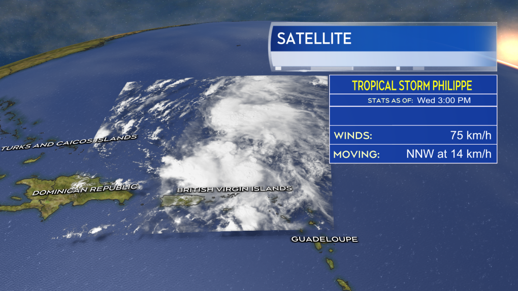 A veratey disorganized Tropical Storm Philippe maintains itself just to the north of the U.S. and British Virgin Islands.
SHIFT TO THE WEST
The official forecast cone issued for tropical storm Philippe by the U.S. National Hurricane Center shifted significantly to the west on Wednesday.
The cone, which is the area the centre of the storm is expected to take a path through, now stretches from western Maine to western Nova Scotia. The cone goes on to include New Brunswick and much of eastern Quebec. As Philippe passes somewhere through that area it is still expected to be a post-tropical storm and likely get tied up in a separate weather front approaching from the west. The Maritimes should see more of a typical fall storm in structure, rather than a tropical storm.
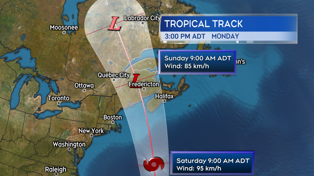 There has been a shift west in the forecast cone for Philippe over the last 24 hours.
WEATHER OUTLOOK
Some areas of the Maritimes are still at risk to pick up rain totals of 50+ mm. There is also still a risk for some parts of the region to see wind gusts reaching 90+ km/h.
At this time, it looks like western New Brunswick into Maine is at highest risk of seeing heavier rain, while western Nova Scotia and the Bay of Fundy coastline in New Brunswick are at the highest risk for the strongest winds.
Wave heights continue to look lower than that of post-tropical storm Lee which means the risk of coastal erosion and wash should be lower.
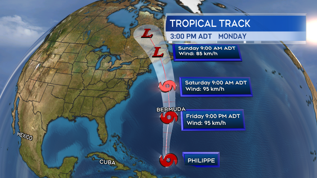 As Philippe nears the Maritimes it is still expected to become post-tropical and combine with a separate weather front approaching from the west.
FASTER ARRIVAL
The arrival time of the rainy and windy weather brought in by the system is expected to start earlier then first forecasted. It now looks like the heavier rain and wind will arrive Saturday evening and night. The region can expect easing and clearing of the weather starting as early as Sunday morning.
We are still more than 72 hours out from the arrival of the storm, meaning there is a significant possibility for change in the timing and areas of impact for the rain and wind. It is not going to be the scale of impact as a Fiona or Dorian and likely less than that of post-tropical storm Lee.
I’ll have continued updates on Philippe on CTV News Atlantic programming and at ctvnewsatlantic.ca
CTVNews.ca Top Stories

Poilievre writes to GG calling for House recall, confidence vote after Singh declares he's ready to bring Liberals down
Conservative Leader Pierre Poilievre has written to Gov. Gen. Mary Simon, imploring her to 'use your authority to inform the prime minister that he must' recall the House of Commons so a non-confidence vote can be held. This move comes in light of NDP Leader Jagmeet Singh publishing a letter stating his caucus 'will vote to bring this government down' sometime in 2025.
School custodian stages surprise for Kitchener, Ont. students ahead of holiday break
He’s no Elf on the Shelf, but maybe closer to Ward of the Board.
Kelly Clarkson's subtle yet satisfying message to anyone single this Christmas
The singer and daytime-talk show host released a fireside video to accompany her 2021 holiday album, “When Christmas Comes Around” that she dubbed, “When Christmas Comes Around…Again.
Judge sentences Quebecer convicted of triple murder who shows 'no remorse'
A Quebecer convicted in a triple murder on Montreal's South Shore has been sentenced to life in prison without chance of parole for 20 years in the second-degree death of Synthia Bussieres.
At least 2 dead, 60 hurt after car drives into German Christmas market in suspected attack
A car plowed into a busy outdoor Christmas market in the eastern German city of Magdeburg on Friday, killing at least two people and injuring at least 60 others in what authorities suspect was an attack.
16-year-old German exchange student dies after North Vancouver crash
A 16-year-old high school student from Germany who was hit by a Jeep in North Vancouver, B.C., last weekend has died in hospital, authorities confirmed.
Poilievre to Trump: 'Canada will never be the 51st state'
Conservative leader Pierre Poilievre is responding to U.S. president-elect Donald Trump’s ongoing suggestions that Canada become the 51st state, saying it will 'never happen.'
Canadiens executive says he has 'no concern' about members of the front office travelling to Russia
Montreal executive vice president of hockey operations Jeff Gorton said he has 'no concern' about members of the Canadiens' front office travelling to Russia with the country’s war in Ukraine ongoing.
Speeding drivers get holiday surprise from 'Officer Grinch'
Drivers in the Florida Keys who exceed the speed limit in school zones may run into a well-known gloomy green creature and get a surprising 'gift.'


