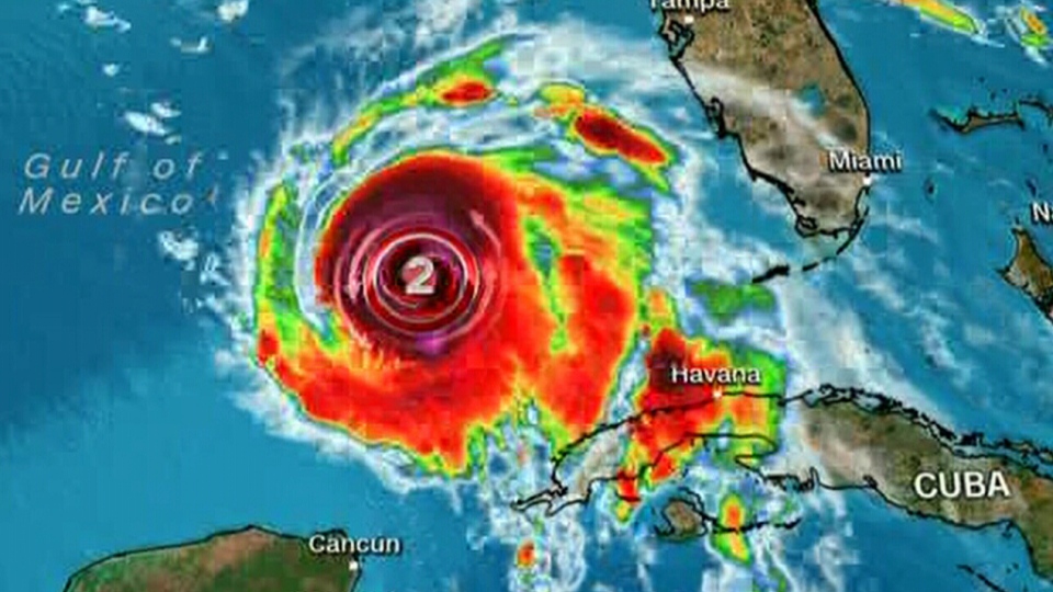
Here’s an update on Hurricane Michael and why it needs to watched in Atlantic Canada through the week.
Michael is a category 2 hurricane with maximum sustained winds near 175 km/h. Michael is forecast to reach category 3 with maximum winds near 205 km/h as it approaches the Florida Panhandle Wednesday morning.
Although we categorize hurricanes by wind speed, the deadliest hazards with these storms are the water hazards, and those do not necessarily scaleup and down with wind speed. As an example of that, we can look back to Florence, which saw a rapid drop in overall wind speed before it made landfall in North Carolina, but resulted in severe/fatal flooding anyways.
Storm surge inundation of 3-9 feet is forecast for the Florida Panhandle coastline with the most severe surge expected on coastal areas between Panama City and Perry, Florida.
As the storm tracks northeast through Florida, Georgia, and South Carolina, local rainfall amounts may exceed 100, 150, and even 200 mm. The severity of inland flooding, while serious, should be less than what was seen with Hurricane Florence due to Michael maintaining and increasing speed to the northeast, as opposed to stalling, as Florence did.
Speaking of movement, the track of the remnants of the storm, which would still be strong though no longer tropical, are expected to take it near or east of the Atlantic coastline of Nova Scotia on Saturday. Should the storm hold east, heavy rain and high winds will remain offshore. If the storm comes closer to the Atlantic coastline, Atlantic coastal Nova Scotia would experience some of that weather. A rough and pounding surf can be expected on the coast in either case.


