
HALIFAX -- After landfalling as a hurricane in North Carolina Monday night, Isaias has been downgraded to a tropical storm as it continues to move north into the northeastern United States.
Some light rain and gusty southwest winds are expected from the system for the Maritime region Tuesday evening and Wednesday.
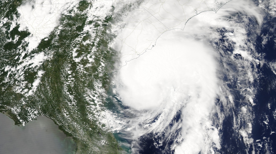
A high-resolution satellite image of Hurricane Isaias as it nears the coastline of the Carolinas on Monday. The storm would landfall in North Carolina that night. Image courtesy of NASA Worldview.
While now inland and forecast to continue to weaken over the next 48 hours, the storm will bring high wind gusts and the risk of flash flooding along a path extending from Virginia into the Eastern Township area of Quebec.
The National Hurricane Center continues to forecast Isaias as a tropical storm moving through Vermont into southern Quebec before becoming a remnant area of low pressure. The westerly track means no significant impact is expected for the Maritimes.
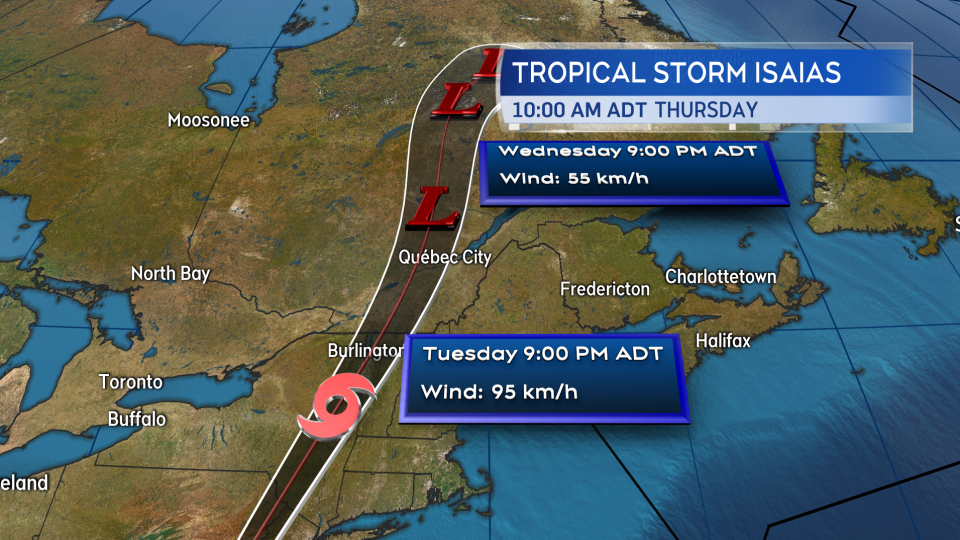 The Tuesday noon update from the NHC continues to forecast Tropical Storm Isaias to pass west of the Maritimes.
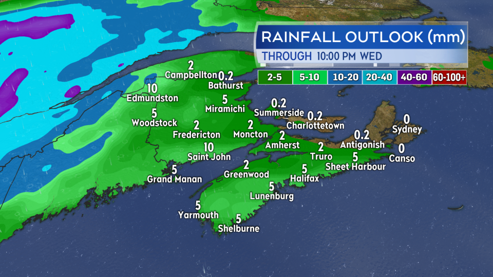
There will be some rain and shower activity that develops in New Brunswick Tuesday evening.
On Wednesday, what is left of that wet weather -- mainly scattered showers -- will clear west to east across the Maritimes in the morning through the afternoon. Some isolated showers will continue in New Brunswick Wednesday evening. Rainfall potential looks low. Most areas with a chance of trace amounts to a few millimetres. Pockets of 5 to 10 mm are possible, but will be most likely near the Bay of Fundy coastline of New Brunswick.
 Broken rain and showers are forecast for the Maritimes Wednesday. Occurring rainfall is expected to be light for most that see it.
The wind will be gusty Wednesday. From a southwest direction it will be sustained 20 to 30 km/h with peak gusts 40 to 60 km/h, except up to 70 km/h in the Tantramar Marsh area of southeastern New Brunswick. Near gale force winds (34 knots) may occur for the St. Lawrence River. Strong winds (20-25 knots) are in the forecast for Lurcher, the Bay of Fundy, Northumberland Strait, Gulf of St. Lawrence, and the waters surrounding Cape Breton. Ocean swells of 1-3 metres are also forecast to develop.
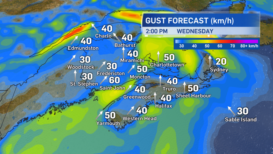 Gusty southwest winds are forecast for Wednesday. They are expected to remain below warning criteria of 90 km/h. Some Gale and Strong Wind Warnings are in effect for marine areas.
Behind the passing system it looks like a return to mainly sunny and hot weather late this week and weekend. Given the hot dry weather of the last few weeks it may have been beneficial if the remnants of Isaias had come close enough to bring us more substantial rain.


