Another powerful storm is en route to Atlantic Canada.
It is being generated by the boundary between cold Arctic air that has broken down south through North America and milder air closer to the eastern seaboard of the US.
Weather conditions will deteriorate quickly Tuesday morning and afternoon. With cold air in place, many locations in the Maritimes will see at least a few snowflakes before a turn to rain. In some places, a few to several slushy centimetres will make for slick spots on roads.
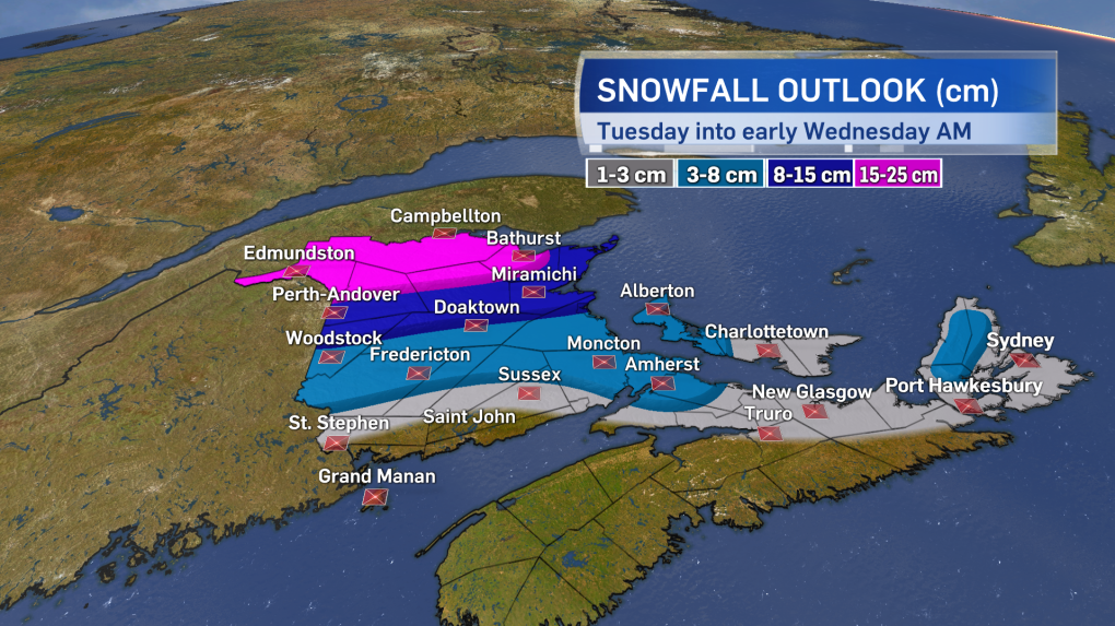
Some areas in New Brunswick along and north of line from Perth-Andover to Miramichi will likely remain as snow and as much as 10 to 20 centimetres could accumulate for that part of the Maritimes. Snowfall warnings have been issued for those areas expected to exceed 15 cm.
Other areas that turn to rain can expect 10 to 30 mm worth, though local amounts may approach 40 mm near the Atlantic coastline of Nova Scotia. While unlikely to cause any major flooding issues, hydroplaning conditions and reduced visibility can be expected in the wind blown rain.
On the topic of winds, the strongest initial winds with the storm will be for Nova Scotia. South and southeast gusts will build into a range of 70 to 100 km/h Tuesday evening and night with the strongest gusts near the Atlantic coastline and in northern Inverness County. Early Wednesday morning the winds swing around to the west in the wake of the storm and increase to include widespread gusts of 50 to 80 km/h for the Maritimes with a risk of gusts 80 to 100 km/h from the northeast of New Brunswick, across P.E.I., and into Cape Breton.
Wind warnings have been posted for parts of Nova Scotia with Environment and Climate Change Canada noting in a weather statement that they may need to be expanded upon.
As with the previous storms, delays and restrictions to transportation services are possible. There is also a risk of power outages with winds that strong.
Temperatures in the west winds will fall very quickly on Wednesday, especially for New Brunswick. Watch for possible icy spots to develop as the temperatures return to or below freezing. The next round of snow, rain, and wind will arrive Friday into Saturday.
