If you’ve been putting off taking the patio furniture inside, today would be a great time to do it.
A fall storm is moving up the St. Lawrence River Valley in Quebec today, and while not coming directly into the Maritimes, it will come close enough to sweep a series of weather fronts through the region.
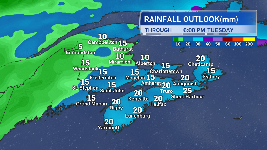
Cloudiness will increase Monday afternoon and rain will develop in the evening and night. A general rainfall of 10 to 20 mm is expected but with higher local amounts of 20 to 40 mm near and along the Atlantic coastline of Nova Scotia.
More noticeable will be the highs winds. Tonight southerly winds will increase to become sustained 30-40 km/h with peak gusts reaching 50-70 km/h, except to near 100 km/h in Inverness County, Cape Breton due to the topography of the Highlands.
As the cold front moves through Tuesday morning, winds will swing west and peak gusts will push 50-80 km/h and as high as near 90 km/h for P.E.I. and Cape Breton. Wind warnings have been issued for both P.E.I. and Cape Breton. Along with being able to blow light objects around, this system is likely to drop quite a few leaves around the Maritimes, especially given we are either near, at, or past peak for the foliage change.
That won’t be the only cold front we contend with this week.
A second low pressure will dip south out of the northern Prairies before moving across Quebec on Wednesday. As the low moves into Newfoundland it will provide a straight shot of colder, Arctic-sourced air. This will move down from Hudson Bay through Quebec and into the Maritimes. This will be some of the coldest air of the season so far.
High temperatures on Thursday will struggle in the low-to-mid single digits with many lows Thursday night falling into a range of -6 to 0. While plenty chilly near the surface, the air above will be even colder, dipping down -10 to -6 just 1.5 km above the ground. That setup is cold enough that there will be a widespread chance of wet flurries across much of the Maritimes. The areas mostly likely to experience the flurries include northern New Brunswick, P.E.I., eastern Nova Scotia including Cape Breton, and the Annapolis Valley, though some wet flakes appearing in other areas can’t be ruled out. Accumulation in any occurring flurries is unlikely as surface temperatures will still be above freezing.
Southerly winds and a chance of rain will end the mini cold snap during the upcoming weekend with cooler October temperatures returning the following week.
