HALIFAX -- It’s tough to get much more in the way of opposite weather conditions between the west coast and east coast of the country this past weekend.
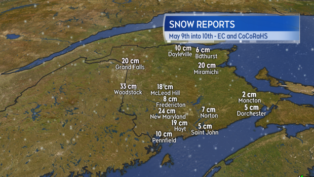
A strong low-pressure system and the presence of a late-season pool of Arctic air that had shifted south into eastern Canada produced a record-setting snowfall in New Brunswick.
Snow amounts in the province varied from a few to several centimetres in the south, to near 20 or 30 cm for central and northern areas of the province. Elevation played a big part in how much added up, with the extreme example near Fredericton. The city area reported totals near 8 cm, but the hills just north and south saw closer to 20 cm. The highest totals came in around the Woodstock-Grafton areas with nearly 33 cm.

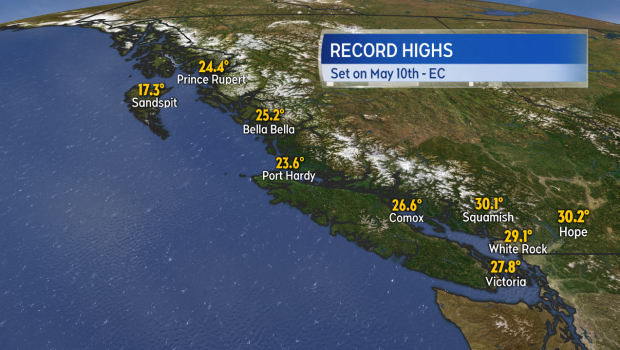
While the east coast dealt with heavy snow, rain, wind, and colder temperatures, it was sunshine and heat in British Columbia. Widespread record-setting high temperatures were reported on Sunday, focused around the coast.

So, why the extremes?
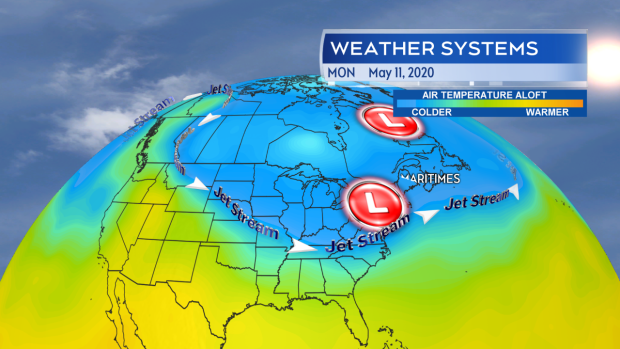
A highly-amplified ridge in the jet stream allowed for a shift of some much warmer continental air to move northward into B.C. while keeping conditions sunny.
At the same time, a plunge southward of the jet stream below the Great Lakes area made it easier for the pool of cold, Arctic air to sink southeast, influencing our Maritime weekend weather.
While the jet-stream pattern is similar to start this week, it is expected to moderate from the weekend extreme over the next several days.


