A developing storm moving northward just off the U.S. eastern seaboard looks likely to bring a heavy early winter snowfall to much of Nova Scotia, Prince Edward Island, and the southeastern corner of New Brunswick.
Snowfall outlook
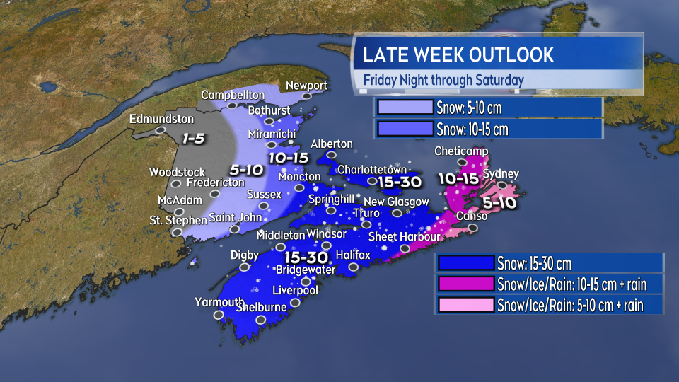
Largely unchanged from Wednesday, the heaviest snow looks most likely to fall across mainland Nova Scotia, Prince Edward Island, and the southeastern corner of New Brunswick.
Southeastern New Brunswick and P.E.I. are under special weather statements calling for possible snow amounts of 15-to-25 cms. Mainland Nova Scotia is under a snowfall warning with 15-to-30 cms of snow expected. The weather agency advises the public to monitor the forecast and future updates as we near the weather event.
I expect that in some areas the snow will approach 30 cm, or one foot of snow, that will pile higher in snow drifts.
Snow totals will be lower on the Eastern Shore of Nova Scotia as far north as Cape Breton. A heavier mix of snow, ice pellets, freezing rain, and rain are expected there.
Less snow is expected in northern and western New Brunswick. Fredericton could see 5 to 10 cm, Saint John 10 to 15 cm, and Moncton 15 to 25 cm.

Timing
There shouldn’t be any big weather issues Friday morning, afternoon or early evening. Mostly cloudy and chilly through that period. Some flurries are possible where the northwest wind blows in off the ocean.
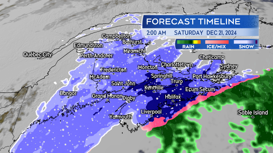
Snow starts in western Nova Scotia around 9 p.m. and continues until midnight Friday, becoming heavy within the first two hours. Be careful of quickly deteriorating conditions soon after the onset of inclement weather.
By midnight Friday, heading into Saturday, heavy snow is expected to fall across the region. It will be lighter in northern and western areas of New Brunswick. Parts of eastern Nova Scotia will change from snow, to ice pellets and freezing rain, to rain Saturday morning.
The heaviest snow is expected to fall overnight Friday and Saturday morning. There will be further snowfall Saturday afternoon and a chance of flurries Saturday night.

Wind
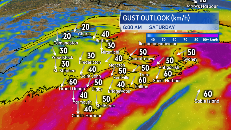
A north and northeast wind with gusts of 30 to 60 km/h will accompany the snow and mixed precipitation Saturday morning. Stronger gusts of 60 to 80 km/h are possible on exposed areas of the Atlantic coast of Nova Scotia.
The wind will switch to northwest by Saturday afternoon but continue to gust between 30 to 60 km/h.
The northwest wind will usher colder air back into the Maritimes through the weekend and into next week. The arrival of the cold air means that snow on the ground could stick around in some areas into Christmas day. The definition of a White Christmas requires 2 cm of snow on the ground Christmas day.

Impacts
Snow covered, slick roads will develop across much of Nova Scotia, Prince Edward Island, and southern areas of New Brunswick late Friday night into Saturday morning. The falling snow and gusty winds could reduce visibility.
It is advisable to postpone travel through areas receiving the heaviest snow if possible. If using a snowblower, you may wish to check that it is in running order before Friday evening and easily accessible for use. Avoid street parking if possible to allow snow clearing operations to be unobstructed. Check on winter parking restrictions.
The wind associated with the storm may impact ferry services in the region. Check websites for those services for the latest on cancellations and delays.


