As planet warms, ferocious snowfalls could increase
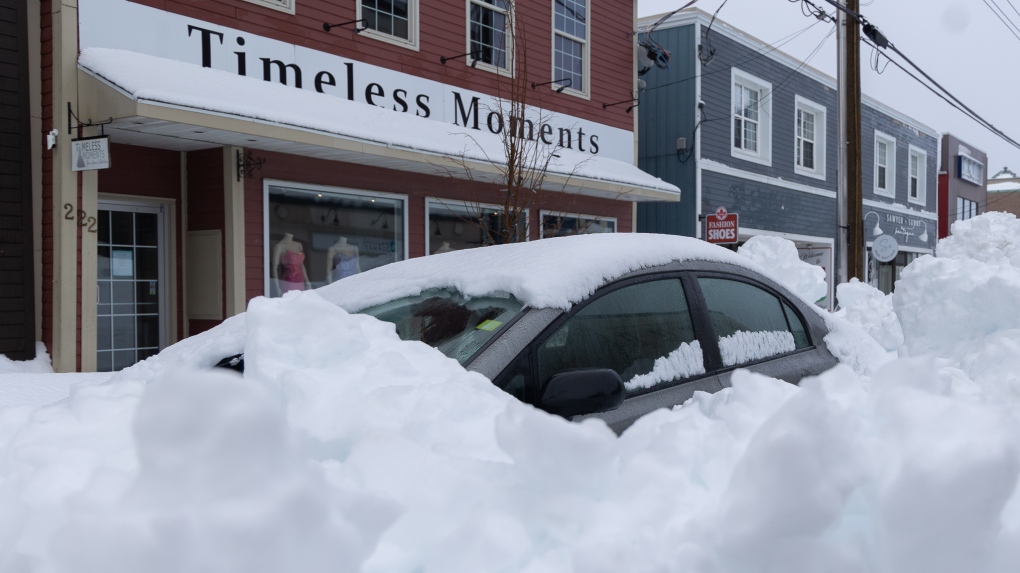
 Vehicle buried after winter storm in Sydney, N.S. on Monday, Feb. 5, 2024. THE CANADIAN PRESS/Shane Wilkie
Forecasters say a warming global climate could actually cause some parts of Canada to see colder conditions, including heavy snowfalls like the one that hit parts of the Maritimes this week.
There's a direct relationship between the temperature of the atmosphere and how much water it can hold, said Judah Cohen, a research affiliate at the Massachusetts Institute of Technology, who works as a director of seasonal forecasting at Verisk Atmospheric and Environmental Research.
"It's like a sponge. If the atmosphere is very warm, it could hold a lot of moisture," he said. "You put all the water in the sponge. And then as you slowly lower the temperatures, it's like squeezing the sponge, and so all the water comes out of it," he said.
Beginning Friday, the sponge got squeezed as a stalled low-pressure system off Nova Scotia's coast dumped up to 150 centimetres of snow in parts of Cape Breton, prompting local states of emergency and a call from the province for federal help in digging out.
About 20 or 30 years ago, Cohen said, the consensus in the scientific community was that a warming world would result in less snow. But now it is believed climate change could lead to more intense snow and rain, he said.
John Clague, a professor of geosciences at Simon Fraser University in Burnaby, B.C., said ocean temperatures in the North Atlantic have increased in recent years, allowing temperate air masses along Canada's East Coast to hold more water vapour. When this moisture-laden warm air comes into contact with arctic air, "crazy" amounts of snow fall, he said.
"In my view, it's another example of extreme weather that may have the fingerprint of climate change on it," he said of the recent Nova Scotia storm.
"No single extreme weather event can be attributed to climate warming, but we have been seeing far more of these extreme events around the world ... It's not inconsistent with climate change."
Clague said the climate in North America is largely controlled by the jet stream. He described the jet stream as a continuous fast-moving band of air that sits high in the atmosphere. It separates polar air in the north from temperate air in the south.
Although wobbly, the jet stream, he said, is usually fairly fixed within a range of latitudes in the Northern Hemisphere.
"But over the past decade, the jet stream has become more snakey and unpredictable -- wandering over a larger range of latitudes," Clague added.
"During this winter storm, the jet stream has moved south and allowed arctic air to move over the Maritimes, impacting populated areas like Nova Scotia and Prince Edward Island."
Cohen agreed, adding that the reason parts of Nova Scotia got more than a metre of snow was the changing jet stream.
An atmospheric ridge caused by the jet stream twisted itself over the continent in an inverted horseshoe shape, making its impact felt on both the East and West Coasts, he said. The stalling of the jet stream caused the air ridge that hit the high pressure to be blocked from moving east, bringing days of rain in California and snow in Nova Scotia.
"It's like a traffic jam in the atmosphere, and weather systems get stuck," Cohen said. "If you're stuck in a high pressure ridge, you are more likely to get a heat wave. Or if you're maybe stuck in a cold trough, you are more likely to get heavy rain events and flooding. And as in the case of Nova Scotia, you can get more snow."
This report by The Canadian Press was first published Feb. 6, 2024.
For more Nova Scotia news visit our dedicated provincial page.
CTVNews.ca Top Stories

Trump threatens to try to take back the Panama Canal. Panama's president balks at the suggestion
Donald Trump suggested Sunday that his new administration could try to regain control of the Panama Canal that the United States “foolishly” ceded to its Central American ally, contending that shippers are charged “ridiculous” fees to pass through the vital transportation channel linking the Atlantic and Pacific Oceans.
Man handed 5th distracted driving charge for using cell phone on Hwy. 417 in Ottawa
An Ottawa driver was charged for using a cell phone behind the wheel on Sunday, the fifth time he has faced distracted driving charges.
Wrongfully convicted N.B. man has mixed feelings since exoneration
Robert Mailman, 76, was exonerated on Jan. 4 of a 1983 murder for which he and his friend Walter Gillespie served lengthy prison terms.
Can the Governor General do what Pierre Poilievre is asking? This expert says no
A historically difficult week for Prime Minister Justin Trudeau and his Liberal government ended with a renewed push from Conservative Leader Pierre Poilievre to topple this government – this time in the form a letter to the Governor General.
opinion Christmas movies for people who don't like Christmas movies
The holidays can bring up a whole gamut of emotions, not just love and goodwill. So CTV film critic Richard Crouse offers up a list of Christmas movies for people who might not enjoy traditional Christmas movies.
More than 7,000 Jeep SUVs recalled in Canada over camera display concern
A software issue potentially affecting the rearview camera display in select Jeep Wagoneer and Grand Cherokee models has prompted a recall of more than 7,000 vehicles.
'I'm still thinking pinch me': lost puppy reunited with family after five years
After almost five years of searching and never giving up hope, the Tuffin family received the best Christmas gift they could have hoped for: being reunited with their long-lost puppy.
10 hospitalized after carbon monoxide poisoning in Ottawa's east end
The Ottawa Police Service says ten people were taken to hospital, with one of them in life-threatening condition, after being exposed to carbon monoxide in the neighbourhood of Vanier on Sunday morning.
New York City police apprehend suspect in the death of a woman found on fire in a subway car
New York City police announced Sunday they have in custody a “person of interest” in the early morning death of a woman who they believe may have fallen asleep on a stationary subway train before being intentionally lit on fire by a man she didn't know.


