HALIFAX -- With polar-sourced air in place across the Maritimes, a coastal storm moving up the eastern seaboard may bring a heavy snowfall to Nova Scotia.
The "ingredients" of this storm have yet to come together. Those include both a low-pressure system moving out of Texas and a weaker system out of Florida. When the two meet near the coast of Virginia late Wednesday, the resulting system will be fueled by the contrast between cold air over the continent and milder air over the Atlantic.
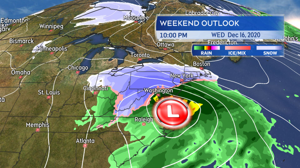
The storm develops in earnest as it moves just off the coast of North Carolina and Virginia late Wednesday.
The storm is expected to have a widespread impact in the northeastern United States with winter storm warnings in place from Virginia all the way through New England. Heavily populated areas such as the New York area and Boston could see snowfall ranging from 15 to upwards of 30 cm.
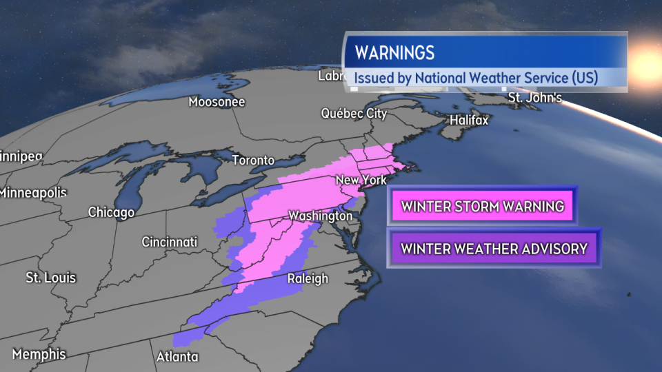
A swath of winter storm warnings and advisories has been issued by the NWS through the northeastern US.
The system is forecast to move north of Cape Cod and then shift east on Thursday. It's at that time that it could impact Nova Scotia with a heavy snowfall.
A special weather statement has been issued by Environment Canada for much of mainland Nova Scotia, cautioning of a Thursday snowfall that could exceed 15 cm. My own outlook has the area from Halifax County and west with a chance of a 10 to 25 cm snowfall.
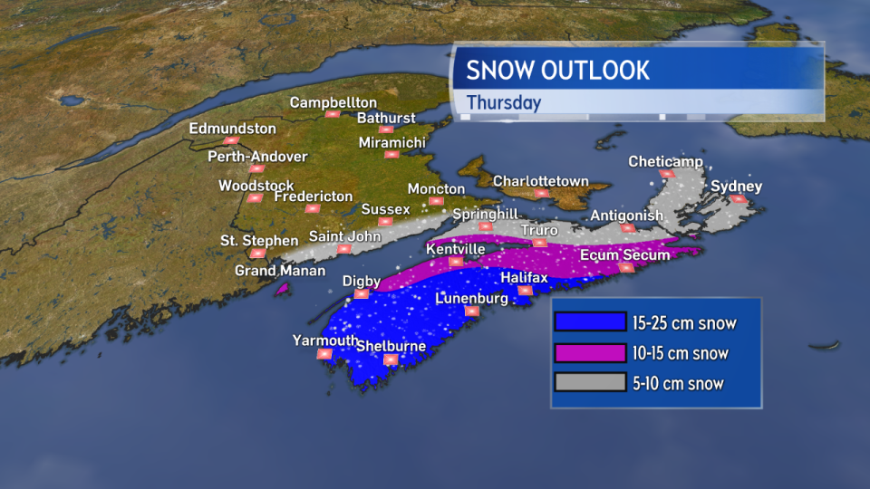
While a degree of uncertainty remains in the forecast it looks like much of western Nova Scotia will have the best shot at a heavy snowfall.
Computer guidance for the system continues to show significant discrepancies between the various weather forecast models operational in North America and globally. Some show less snow for Nova Scotia with a track that holds the system further to our south. Others push the heavier snowfall amounts across much of the province and close to New Brunswick and P.E.I.
It is not uncommon for a rapidly-developing storm such as this to have that type of uncertainty at this stage of the forecast. I expect to have to update my snowfall outlook on Wednesday as the system starts to come together in earnest.
What is more certain is the timing. This will be a Thursday event starting in the morning hours and ending evening and night. I'll have updates on the forecast Wednesday on CTV Atlantic News at Noon, 5, 6, and 11:30 p.m.


