Snowfall warnings issued for Cape Breton as cold front moves across the region
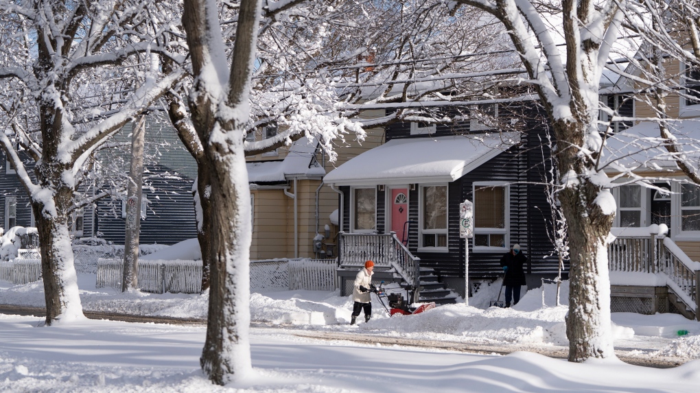
 A person clears snow with a snowblower following a major winter storm in Halifax on Friday, March 3, 2023. (THE CANADIAN PRESS/Darren Calabrese)
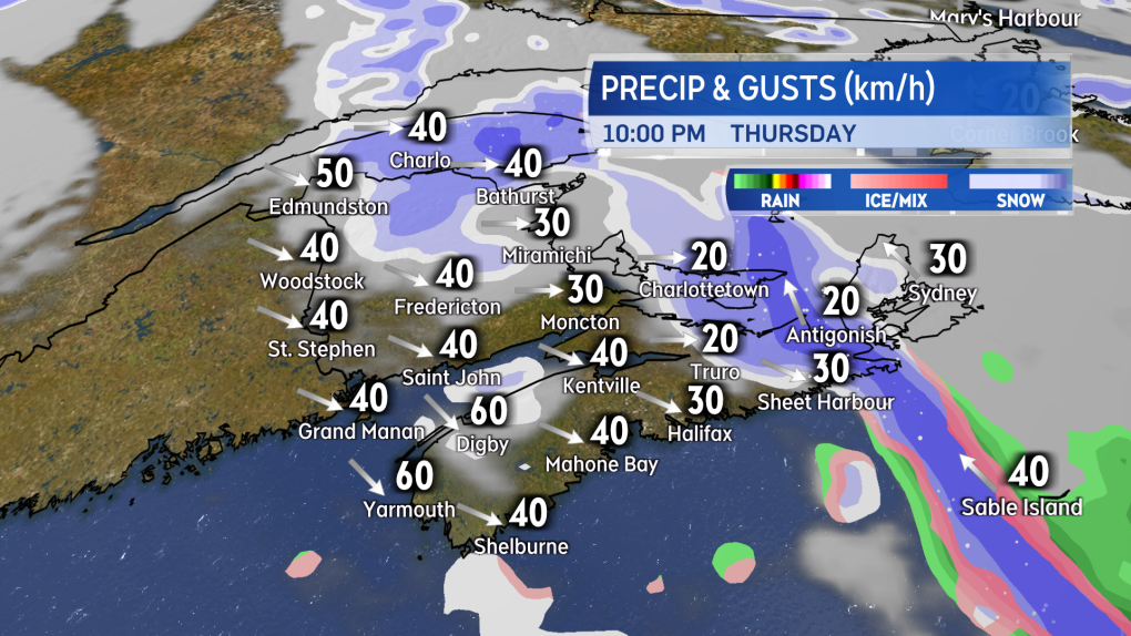
A cold front bringing in a mix of snow and rain will continue into eastern parts of the Maritimes Thursday evening and night.
The inclement weather has come with squall-like conditions, producing brief periods of heavier snow, reducing visibility and creating some accumulation. The system slows Thursday night in the vicinity of Cape Breton, keeping that part of the Maritimes in a more prolonged period of snow.
 Snow advances into eastern areas of the Maritimes Thursday evening and night along with the cold front.
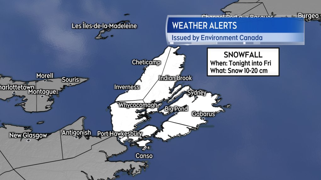
Environment Canada has issued a snowfall warning for Cape Breton. The warning cautions on snow amounts of 10 to 20 cm Thursday night through Friday morning. The agency also remarks, “the snowfall will likely be quite variable across the Island.”
 A Snowfall warning is in effect for Cape Breton.
Cape Breton has had more than its share of snow this March. The Sydney Airport reporting 81 cm so far, with the 30-year climate average for the month at 48 cm.The weather station at North Mountain in Victoria County is reporting 142 cm of snow on the ground, which does trail the record of 217 cm reported at the site on March 30, 2001.
The spring snow has been a boon for some of the ski areas in Cape Breton with Ski Cape Smokey remaining open into Easter weekend.
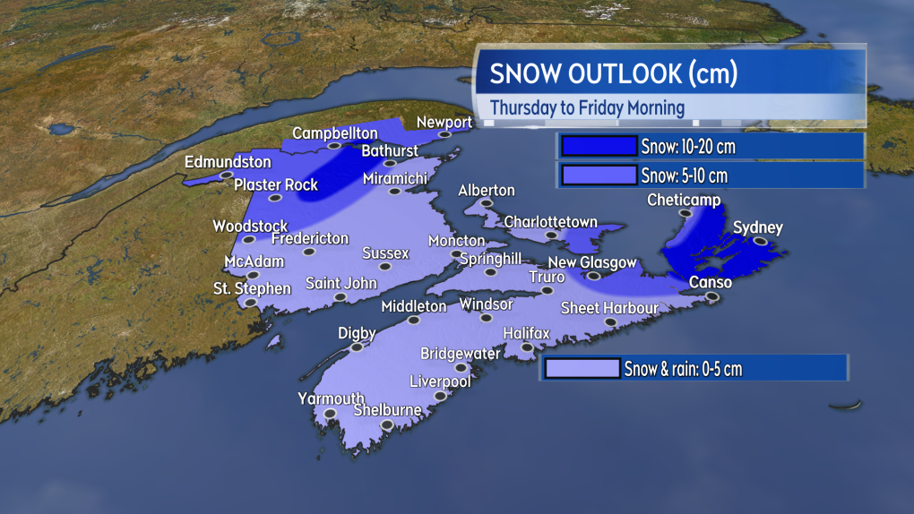
Friday morning, snow in Cape Breton is expected to ease to a chance of flurries by the afternoon.
 Some of the more mountainous terrain in northern New Brunswick along with Cape Breton are the areas in the Maritimes most likely to see a snowfall of 10+ cm.
The next weather system to impact the Maritimes will arrive on the weekend. A strong low will move from southern Ontario and into the St. Lawrence River Valley.
The weather fronts from the system will come across the Maritimes Saturday into Sunday. Snow turning to rain will develop across the region, west-to-east, Saturday morning into the afternoon.
The snow may accumulate a slushy five to 10 cm in northern areas of New Brunswick. Scattered showers and flurries will linger in the wake of the system on Sunday along with a gusty northwest wind.
Forecast updates and regional weather conditions on CTV News Atlantic 5, 6, and 11:30 p.m.
CTVNews.ca Top Stories

'We'll never be the 51st state,' Premier Ford says following Trump’s latest jab
Ontario Premier Doug Ford says Canada will 'never be the 51st state,' rebuking U.S. President-elect Donald Trump’s latest social media post.
B.C. man drops camera into ocean, accidentally captures 'breathtaking' whale video
Before it turned into an extraordinary day, Peter Mieras says it began being quite ordinary.
'Why would I box myself in?': Singh on why he won't commit to helping bring Trudeau's gov't down, yet
NDP Leader Jagmeet Singh says U.S. president-elect Donald Trump's looming tariff threat is part of the reason why he's not committing to voting non-confidence in Prime Minister Justin Trudeau's government.
Elon Musk comes out swinging against government spending package in early test of his political might
Elon Musk derided a Republican-backed government spending bill that if not passed by Friday night would lead to a government shut down.
Providing MAID to man on day pass from B.C. psychiatric ward was 'unlawful,' family alleges
A 52-year-old man who was provided with a medically assisted death while out on a day pass from a B.C. psychiatric hospital should never have been approved for the life-ending procedure, his family alleges in a recently filed wrongful death lawsuit.
Donald Trump says Canada becoming 51st U.S. state is 'a great idea.' Jean Charest calls the comment a 'wake-up call'
U.S. President-elect Donald Trump is taking aim at Canada once more, saying it would be 'a great idea' to make it America's ‘51st state.'
Fashion influencer Matilda Djerf apologizes following report she created a toxic workplace
A social media influencer has issued an apology after reports that she created a 'work environment filled with fear and psychological pressure' at her company.
Police suspect Utah father killed his wife and 3 kids, wounded son, then killed himself
Five people were found dead in a Utah home after a man apparently shot his wife and four children before killing himself, police said Wednesday. A 17-year-old boy survived but has a severe brain injury.
What's the best treatment for ADHD? Large new study offers clues
Stimulant medications and certain therapies are more effective in treating ADHD symptoms than placebos, a new study on more than 14,000 adults has found.


