As the day’s cloud clears for much of the region Thursday night, conditions become better for night sky viewing, including the currently active Taurid meteor shower.
Thursday night sky
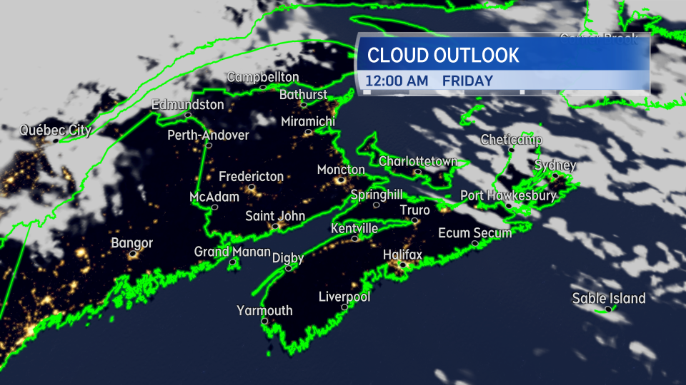
Clearing cloud cover is forecast for much of New Brunswick, mainland Nova Scotia, and western Prince Edward Island Thursday evening and night. Partly cloudy conditions persist for eastern P.E.I. and parts of eastern Nova Scotia, including the north shore of the mainland and Cape Breton.
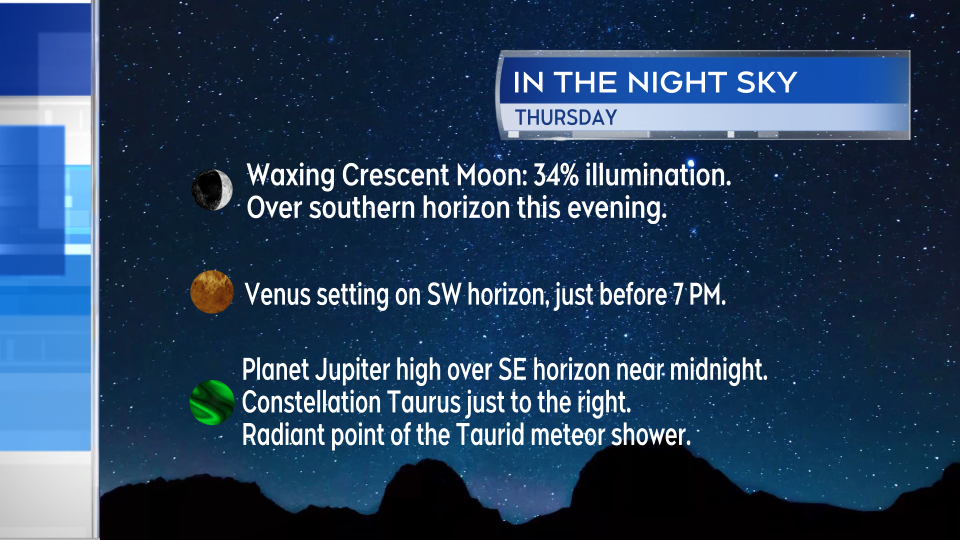
Look for the waxing crescent moon over the southern horizon just after sunset. If you then turn your gaze towards the southwest, you should be able to spot the planet Venus, which will then set just before 7 p.m.
The planet Jupiter will be rising over the eastern horizon by near 8:30 p.m. Located just to the right of Jupiter will be the bright star Aldebaran, part of the constellation Taurus. That constellation is the radiant point of the Taurid meteor shower.
By midnight, the constellation will reach its highest point in the night sky, high over the southeastern horizon. That would be an ideal time to start watching for some potential meteors. The shower typically produces up to near five meteors-per hour. You will want to get away from city lights and allow your eyes time to adjust to the dark if you are attempting to view. Patience is required as well as five meteors-per hour isn’t all that much. Dress warm as most low temperatures in the region Thursday will fall into a range of zero-to-six degrees.
Cool Friday, second cold front comes through
High temperatures on Friday will be seasonably cool, mostly ranging from high single digits into the low teens. Expect increasing cloudiness with some spotty showers developing through the day. The highest chance of showers is in the north of New Brunswick, the north of mainland Nova Scotia and Cape Breton, and P.E.I. There will be a gusty westerly wind, sustained 20 to 40 km/h, with gusts 40 to 60 km/h.
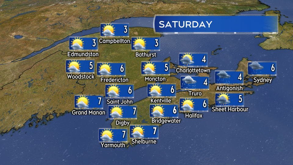
The cold front clears the region Friday evening. A brisk northwest wind persists for Saturday and keeps high temperatures in the low-to-mid single digits for the Maritimes. As the northwest wind blows over the Gulf of St. Lawrence, it may bring a mix of flurries and showers into P.E.I., the north shore of mainland Nova Scotia, and Cape Breton. Accumulating snow is possible in the highest terrain of the Cape Breton Highlands.
Hurricane Rafael update
After impacting western Cuba, Hurricane Rafael is now a Category 2 hurricane in the Gulf of Mexico. It is expected to move due west while weakening to a Category 1 hurricane Friday. In the latest forecast by the National Hurricane Center, the storm is expected to meander in the central Gulf of Mexico this weekend before taking a turn to the south on Monday. That is favourable for reducing the risk of significant weather impacts to the Gulf states this weekend.
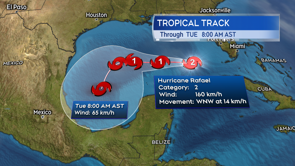
The storm continues to pose no risk to the Maritimes or Atlantic Canada in the extended forecast.


