
HALIFAX -- Things are still on track for a snowy Wednesday for much of the Maritime region.
As a strengthening low-pressure system moves past just off the Atlantic coastline of Nova Scotia, bands of snow will wrap back into that province, Prince Edward Island, and southern areas of New Brunswick.
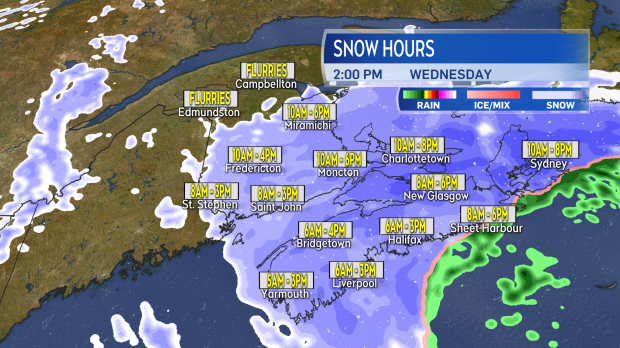
The snow will develop through the morning, will continue in the afternoon, and break down to scattered flurries during the evening and night.
Below you can find a map with the period of time that the most snow will fall for several communities in the Maritimes.
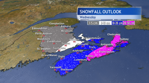
As above, snow will be heaviest in Nova Scotia, and numerous snowfall warnings have been issued for the province by Environment Canada. The greatest potential to see snowfall near or in excess of 20 centimetres is Halifax and into eastern Nova Scotia, including Cape Breton. Much of the rest of the province, as well as central and eastern P.E.I., will see 10 to 20 cm of snow.
Amounts taper lower for New Brunswick through Saint John through Moncton and the southeast will see 5 cm to 10 cm.
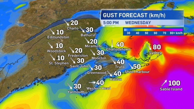
Winds will increase to include peak gusts of 40 km/h to 70 km/h from a north and northwest direction Wednesday. Coastal areas and high terrain in Cape Breton will hit slightly stronger gusts near 80 km/h. While below-warning criteria, the wind will contribute to areas of blowing and drifting snow for N.S. and P.E.I.
It will be travel primarily affected by weather conditions Wednesday. Roads will be snow-covered and slippery, with reduced visibility at times. Delays may also be experienced with some transportation services such as airports, ferries, and bridges.
It's a bit of a break Thursday and Friday, with the weekend forecast seeing back-to-back low-pressure systems arriving, with a mix of rain and snow.


