Mapping program Mounties struggled to open could have helped contain N.S. mass killer
HALIFAX -
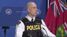
A report looking into a mapping program the RCMP had access to -- but couldn't open -- during the 2020 mass shooting in Nova Scotia concludes it could have helped contain the killer's rampage.
The study by Brian Corbett, an analyst with the inquiry, compares images of potential escape routes the RCMP viewed on Google Earth with what they could have seen through Pictometry -- the trade name at the time for a program that uses high-resolution aerial images.
The inquiry has heard that after killing 13 people in Portapique, N.S., the gunman drove his replica police car along a narrow dirt road that led to three intersections that weren't initially being watched.
RCMP supervisors have said they chose just to block the main road because the mapping images they used suggested to them the smaller routes weren't passable by car.
However, Corbett found Pictometry "makes it more apparent that these are driveable roads," while the Google Earth image is "unclear."
After comparing maps of key escape routes, Corbett wrote, "Pictometry imagery would have given the RCMP a better understanding of the road networks in Portapique, thereby enhancing containment efforts." At the time, the program was referred to as Pictometry, but it is now called Eagleview, the name of the U.S. parent company.
On April 18, 2020, at 10:32 p.m., as the first three Mounties advanced into the community on foot, Const. Vicki Colford was stationed at the main road's intersection with the highway. A fifth RCMP officer went to the same location at 10:43 p.m.
The inquiry has said that sometime between 10:41 p.m. and 10:45 p.m., the killer slipped away onto Highway 2 and drove to an industrial park in Debert, N.S., before killing nine more people on April 19. According to inquiry documents, the killer escaped on a dirt road next to a blueberry field at the southern end of Portapique, reaching a U-shaped loop that connected with the highway east of where Colford was stationed.
The first officer to supervise the response, Staff Sgt. Brian Rehill, said in an interview with the inquiry last year the maps he saw showed "little gravel roads," but he believed there was only one route out of the enclave by car. "That's where I had all the containment set up," he said.
Jen MacCallum, a supervisor at the RCMP's Operational Communications Centre who worked with Rehill that night, said in an interview with the inquiry that Pictometry "was not working that night."
"I was trying to get the passwords and everything to work, I could not," she said, adding that a "millennial techie guy" in her office also couldn't solve the issue.
Staff Sgt. Addie MacCallum, a district commander in Pictou County who assisted that night, also said he couldn't open the Pictometry program in RCMP headquarters in Bible Hill, where several of the incident supervisors were stationed in the early hours.
"I start trying to go and find Pictometry, which each detachment's supposed to have. I couldn't find it, and (Staff Sgt.) Al Carroll (the local district commander at the time) didn't know where it was .... We end up pulling a map off the wall. We put it on the table and start hand drawing on it," he said.
Like Rehill, he said it seemed there was only one road in and out of Portapique.
Tara Miller, a lawyer participating in the inquiry on behalf of a victim's family member, said in an interview last week that using the best programs in emergencies like the mass shooting should have been a normal process for incident commanders.
"Those were the critical moments to have been able to lock down Portapique and secure the containment," Miller said of the initial period when the killer was still in the rural, wooded area.
"If they have these resources, they should be able to access them in the critical moments when they're needed the most," she said.
Allan Ladouceur, district manager with Pictometry Canada Corp., a subsidiary of Eagleview Technology, said in an interview Tuesday the RCMP have access to online training resources as part of the licence permitting them to use the web-based program.
Staff Sgt. Steve Halliday, another supervisor of the RCMP response, has testified that when he came on duty, "there was a belief" the main road was the only way out.
He testified that it was only at about 4 a.m. or 4:30 a.m. on April 19, when he saw a better map, that he came to realize smaller roads might have allowed the killer to escape "by all-terrain vehicle or whatever," and he ordered the exits blocked by two Mounties.
Under cross-examination by Miller last week, Halliday said, "Pictometry certainly would have provided ... a more clear view, I think."
Rob Gordon, a criminology professor at Simon Fraser University, said in an interview last week that it's important for incident commanders to be well-trained in how to use mapping technology.
He said without good mapping, the commanders "won't be able to piece things together in a sensible way, unless they know the area really well."
This report by The Canadian Press was first published May 24, 2022.


CTVNews.ca Top Stories

'A beautiful soul': Funeral held for baby boy killed in wrong-way crash on Highway 401
A funeral was held on Wednesday for a three-month-old boy who died after being involved in a wrong-way crash on Highway 401 in Whitby last week.
Police handcuff man trying to enter Drake's Toronto mansion
Toronto police say a man was taken into custody outside Drake's Bridle Path mansion Wednesday afternoon after he tried to gain access to the residence.
Biden says he will stop sending bombs and artillery shells to Israel if they launch major invasion of Rafah
U.S. President Joe Biden said for the first time Wednesday he would halt shipments of American weapons to Israel, which he acknowledged have been used to kill civilians in Gaza, if Prime Minister Benjamin Netanyahu orders a major invasion of the city of Rafah.
U.S. presidential candidate RFK Jr. had a brain worm, has recovered, campaign says
Independent U.S. presidential candidate Robert F. Kennedy Jr. had a parasite in his brain more than a decade ago, but has fully recovered, his campaign said, after the New York Times reported about the ailment.
What is whooping cough and should Canadians be concerned as Europe declares outbreak?
There is currently a whooping cough epidemic in Europe, with 10 times as many cases compared to the previous two years. While an outbreak has not been declared nationwide in Canada, whooping cough is regularly detected in the country.
Pfizer agrees to settle more than 10K lawsuits over Zantac cancer risk: Bloomberg News
Pfizer has agreed to settle more than 10,000 lawsuits about cancer risks related to the now discontinued heartburn drug Zantac, Bloomberg News reported on Wednesday, citing people familiar with the deal.
Quebec premier defends new museum on Quebecois nation after Indigenous criticism
Quebec Premier Francois Legault is defending his comments about a new history museum after he was accused by a prominent First Nations group of trying to erase their history.
B.C. theatre to pay $55K to neurodivergent actor in discrimination case
British Columbia's human rights tribunal has awarded a neurodigergent actor, who was diagnosed with sensory and learning disorders, more than $55,000 after finding that a Kelowna theatre company discriminated against him because of his disabilities.
Who's responsible for regulating cannabis stores operating under the sovereignty banner?
It's not quite clear who is supposed to be regulating so-called sovereign cannabis stores or even ensure they're benefiting Indigenous communities.
Shopping Trends
The Shopping Trends team is independent of the journalists at CTV News. We may earn a commission when you use our links to shop. Read about us.


Toronto
-
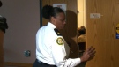
Systemic failure to promote Black officers under microscope as superintendent apologizes for helping racialized police cheat
In emotional and raw testimony at a disciplinary tribunal, the first Black female superintendent in the Toronto Police Service apologized for helping racialized constables cheat a promotional exam.
-
Police handcuff man trying to enter Drake's Toronto mansion
Toronto police say a man was taken into custody outside Drake's Bridle Path mansion Wednesday afternoon after he tried to gain access to the residence.
-
'A beautiful soul': Funeral held for baby boy killed in wrong-way crash on Highway 401
A funeral was held on Wednesday for a three-month-old boy who died after being involved in a wrong-way crash on Highway 401 in Whitby last week.
Calgary
-

Calgary man charged with sexual assault of Cowboys patron
Calgary police have charged a man with the sexual assault of a woman he met at a downtown club.
-
Suspect in Nijjar killing alleged to have studied briefly at Bow Valley College in Calgary
One of the accused in the murder of British Columbia Sikh activist Hardeep Singh Nijjar appears to have spent a short period of time as a student at Bow Valley College in Calgary.
-
Nenshi taking heat on labour record from fellow Alberta NDP leadership candidates
Candidates vying to be the next leader of Alberta’s Opposition NDP want answers from presumed front-runner Naheed Nenshi about a five-year-old letter that they say signals he is anti-union.
Edmonton
-

Size of Vancouver Island burned in 2023 Alberta wildfires: ABMI report
A group of researchers who studied the historic 2023 Alberta wildfires calls them “remarkable” at least in recent history.
-
Elks report net loss of $3.9M for 2023 as team narrows list of potential new owners
While the Green and Gold are bleeding even more red ink, shareholders of Edmonton's Canadian Football League franchise heard Wednesday at its annual general meeting there's hope on the horizon.
-
Vehicle found burning on Anthony Henday Drive east of Edmonton
Police in Strathcona County are looking for information after a vehicle fire on Anthony Henday Drive.
Montreal
-

English CEGEPs struggling with requirements under Bill 96; French language minister says it's necessary
Quebec's minister for the French language says if English CEGEPs are having a problem with the new French-language exam for students, it only shows that the province's language laws are necessary.
-
No more doctor's note: Quebec bill would scrap paperwork for massages, medical equipment
On Wednesday, Labour Minister Jean Boulet announced that he will table a bill to cut red tape, so that family doctors can free up an additional 500,000 medical appointments for patients each year by a plan to put an end to require a medical note in order to be reimbursed by an insurance company.
-
WATCH THE VIDEO
WATCH THE VIDEO Actor Gouchy Boy charged with assaulting Montreal photographer before sentencing on sex assault
A Quebec actor known as Gouchy Boy was charged with assaulting a photographer at a Montreal-area courthouse Wednesday minutes before he was sentenced for sexual assault.
Ottawa
-

'Summer of discontent': Federal unions vow to fight new 3-day a week office mandate
Federal unions are launching legal challenges and encouraging public sector workers to file "tens of thousands" of grievances over the new mandate requiring federal workers to return to the office at least three days a week in the fall.
-
High school student fatally stabbed in Nepean remembered as 'beloved' son
A 15-year-old who was fatally stabbed last week is being remembered as a "beloved son, brother, cousin, nephew, grandson and friend."
-
1 person injured in afternoon fire in the Glebe
One person was injured Wednesday afternoon in a house fire in the Glebe.
London
-

More than 150 townhomes in northeast London have lost mail service due to off-leash dog
‘It’s a rough situation.’ Townhome residents on Briarhill Avenue have been without mail deliver for about two months.
-
Mother testifies in own defence at disturbing child abuse trial
The mother involved in a shocking child abuse case in London, Ont. took the stand on Wednesday, denying that she ever harmed her children.
-
TSB concludes investigation into cause of London, Ont. freight train fire
More than two weeks after a freight train with several railcars ablaze rolled through the heart of the Forest City, the Transportation Safety Board (TSB) has concluded its investigation.
Barrie
-

Barrie business owner fed up over repeated break-ins since opening
A small business owner in Barrie is fed up after his establishment has been the target of crime multiple times since opening in 2019.
-
Crown seeks 6 years jail time for Barrie woman guilty of impaired driving causing bodily harm
An emotional Cassie Korzenko walked into the Barrie Courthouse Wednesday morning with family members by her side ahead of a sentencing hearing.
-
14-year-old charged after high school lockdown
A 14-year-old from Orillia has been charged with mischief after a threat was made toward an Orillia high school on Wednesday.
Northern Ontario
-
Seven northern Ont. men busted in huge online child exploitation investigation
A province-wide child sexual abuse investigation by Ontario Provincial Police dubbed Project Aquatic has resulted in hundreds of charges, including seven male suspects from northern Ontario.
-
'Ozempic babies': Reports of surprise pregnancies raise new questions about weight loss drugs
Numerous women have shared stories of 'Ozempic babies' on social media. But the joy some experience in discovering pregnancies may come with anxiety about the unknowns.
-
Ontario man devastated to learn $150,000 line of credit isn't insured after wife dies
An Ontario man found out that a line of credit he thought was insured actually isn't after his wife of 50 years died.
Kitchener
-

Who's responsible for regulating cannabis stores operating under the sovereignty banner?
It's not quite clear who is supposed to be regulating so-called sovereign cannabis stores or even ensure they're benefiting Indigenous communities.
-
'The bins aren’t appropriate': Residents react to Waterloo Region’s proposed waste collection program
A pricey plan, proposed by staff for the Region of Waterloo, would see a new fleet of garbage trucks and carts replace bags.
-
64 people charged in Ontario child exploitation investigations
Ontario Provincial Police say 64 people have been arrested and a combined 348 charges have been laid in connection with a series of child exploitation investigations that spanned across the province.
Windsor
-

'Predators go where children go': 5 local people arrested, charged through Project Aquatic
Four people from Windsor, one of whom is 16 years old, and one person from Chatham are now charged with offences including possessing, accessing and making available child pornography.
-
'I wouldn’t trade it for anything': Caesars Windsor celebrates 30 years in the community
To celebrate their 30-year presence in the Windsor community, Caesars Windsor employees are rolling up their sleeves this week, volunteering at six local non-profit organizations.
-
Death deemed not suspicious after body found near Tecumseh Mall
Windsor police say the death was not suspicious after a body was found near an east Windsor mall.
Winnipeg
-
'I killed four people': Trial hears video evidence of Jeremy Skibicki at Winnipeg trial
“I killed four people,” alleged serial killer Jeremy Skibicki told two homicide detectives during a recorded interview played as evidence in his trial Wednesday.
-
Proposed class-action lawsuit launched against Manitoba government for use of solitary confinement in prisons
A proposed class-action lawsuit has been filed against the Manitoba government by a previous inmate for the use of solitary confinement, calling the practice, "cruel, inhumane, and degrading treatment."
-
Grab your gear: Camping season set to kick off in Manitoba
Get your gear ready – camping season has officially arrived in Manitoba.
Regina
-

Sask. parents of autistic children denounce lack of specialized learning in schools
Parents of children with autism joined MLAs in the legislature on Wednesday to rally against cuts for specialized learning in schools.
-
Fort Qu'Appelle high school students hold smudge walk to honour MMIWG
On Monday, students from Bert Fox Community High School led a smudge walk through Fort Qu’Appelle to bring awareness to missing and murdered Indigenous women and girls.
-
'Lax environment' contributed to 2020 deaths of 2 SaskPower workers
A Saskatchewan judge has found SaskPower guilty of three workplace-safety related violations over an incident that left two workers dead in Weyburn.
Saskatoon
-

Sask. barista prepares to roast competitors at national coffee competition
A competitor from Saskatoon is heading to Vancouver for a competition that promises to be quite the grind.
-
'Written off': Sask. woman says her brother, who had Down syndrome, fell through the cracks
Tara Jo Kadlec has been advocating for better care for her brother Cory for years.
-
From CTV's archive: Watch the Regina Pats score 17 goals in one 1985 playoff game
There have been some crazy WHL playoff games over the years. But a team scoring 17 goals? In one game?
Vancouver
-
Kamloops RCMP issue public warning about 2 men allegedly at centre of 'organized crime conflict'
After four targeted shootings in four days, Mounties in Kamloops are taking the unusual step of warning the public about two men they believe are likely to be targeted in future violent incidents.
-
B.C. mink farms' challenge to government ban dismissed in court
Five different lawsuits from B.C. mink farms seeking to reverse the provincial government's ban on their industry have been tossed out of the province's Supreme Court.
-
Vancouver cop who struck pedestrian with cruiser fined $2,000
A police officer who struck a pedestrian with his cruiser while speeding through Vancouver's Downtown Eastside nearly two years ago has been fined $2,000.
Vancouver Island
-

B.C. expanding 3 provincial campgrounds this year
Good news for campers looking for a spot this summer: B.C. is expanding three provincial campgrounds, two on Vancouver Island and one on the mainland.
-
B.C. theatre to pay $55K to neurodivergent actor in discrimination case
British Columbia's human rights tribunal has awarded a neurodigergent actor, who was diagnosed with sensory and learning disorders, more than $55,000 after finding that a Kelowna theatre company discriminated against him because of his disabilities.
-
TSB releases report into fatal Vancouver Island floatplane crash
A floatplane crash that killed two people on the west coast of Vancouver Island last summer was caused by a collision with a boat wake or an object in the water, according to an investigation report published by the Transportation Safety Board of Canada Wednesday.
Kelowna
-
Kamloops RCMP issue public warning about 2 men allegedly at centre of 'organized crime conflict'
After four targeted shootings in four days, Mounties in Kamloops are taking the unusual step of warning the public about two men they believe are likely to be targeted in future violent incidents.
-
Community mourns thousands of fish lost as B.C. drought risk looms again
Images of steelhead and trout flicker over long sheets of paper, brought to life in blue and green crayon rubbings by the thousands.
-
4th targeted shooting in as many days in Kamloops: RCMP
A man was taken to hospital with non-life-threatening injuries after a shooting in Kamloops Monday evening, the fourth incident police say is part of an ongoing drug conflict playing out on the city's streets.


