Maritime weather: Special weather statements issued ahead of Thursday storm
 Icicles from freezing rain hang from a bench in Fredericton on Tuesday, December 15, 2015. THE CANADIAN PRESS/Stephen MacGillivray
Weather statements
Environment Canada has issued special weather statements for southern New Brunswick, Prince Edward Island, and Nova Scotia. The statement is valid Thursday through Friday. It cautions of a mix of snow, ice pellets, freezing rain, and rain arriving in the region.
For New Brunswick, rain amounts of 25 to 50 mm is expected along the Fundy coast. There will be a risk of freezing rain for the Kennebecasis Valley and Petitcodiac River areas. High snow and ice pellets accumulations up to 25 cm is possible for southeastern New Brunswick.
For Nova Scotia, rain amounts of 25 to 50+ mm is expected, along with a risk of extensive freezing rain in northern and eastern areas of the province. Snow and ice pellets could accumulate up to 20 cm for northern regions.
For Prince Edward Island, rain amounts of 15 to 25 mm is expected. There will also be a risk of a period of freezing rain. Finally, a turn to snow and ice pellets could accumulate up to 25 cm.
Please take the time to check the details of the weather alerts in effect for your specific area. This system will bring highly varied, but impactful, weather conditions across the Maritime region.
 Special weather statements issued for the Maritime provinces on Tuesday.
Arrival of heavy rain
Rain, heavy at times, develop across the province of Nova Scotia through the day on Thursday. The heavy rain could reach the southernmost areas of New Brunswick. The remainder of New Brunswick and Prince Edward Island can expect a mix of snow, ice pellets, and freezing rain during the day.
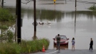
I have rain totals as high as 40 to 85 mm for the province of Nova Scotia. Rain totals reaching, or exceeding, 80 mm will come with an increased risk of localized flooding. A change from the rain to an extended period of freezing rain is possible Thursday evening and night. The freezing rain is likely to be most impactful in northern and interior areas of mainland Nova Scotia as well as across Cape Breton. Several hours of freezing rain will develop icy surfaces and could collect enough on tree branches to break them, which may result in power outages should they contact lines.
 The system starts as heavy rain for the province of Nova Scotia. Some initial rain is possible for New Brunswick and Prince Edward Island before a turn to snow, ice pellets, and freezing rain.
Heavy snow and ice pellets
New Brunswick and Prince Edward Island are likely to see any initial rain turn to a mixture of snow and ice pellets during the day on Thursday. Accumulations of snow and ice pellets could total two to 10 cm for much of northern and western New Brunswick. Accumulations for southeastern New Brunswick and Prince Edward Island could total 10 to 25 cm as the mix continues into Thursday evening and night. Expect snow-covered and slippery road conditions to develop.
 Snow and ice pellets continue to accumulate in southeastern New Brunswick and Prince Edward Island Thursday night. Rain in Nova Scotia will turn to snow, ice pellets, and freezing rain.
Northern areas of Nova Scotia could also switch to a period of heavy snow and ice pellets Thursday evening and night. The risk of accumulations from 10 to 20 cm in that province are highest for Cumberland, Colchester, Pictou, Antigonish, Inverness, Victoria, and Cape Breton counties. Lower, but still slick, accumulations of snow, ice pellets, and freezing rain are possible in the Atlantic coastal counties of Nova Scotia for Friday morning.
 By Friday morning, even Atlantic coastal Nova Scotia should be cautious of slick surfaces as temperatures comes down enough to turn the rain over to a snow-ice mix there.
Wind gusty, but direction the issue
Wind gusts of 30 to 60 km/h are expected to accompany the wintry mix of weather. Initially out of the south for the province of Nova Scotia, it keeps milder air in place there, hence the rain start. A north-northeast wind will persist for New Brunswick and Prince Edward Island, bringing in colder air, turning the rain over to a mix of snow, ice pellets, and freezing rain.
The north-northeast wind then develops for Nova Scotia by Thursday afternoon. Colder air builds into that province, turning the rain over to freezing rain or a mix of snow and ice pellets. While not a flash freeze situation, the fall in temperatures brought on by the northerly wind is likely to be enough to bring surfaces down to the freezing mark across all of Nova Scotia by Friday morning.
 Currently, it looks like the southeast of New Brunswick, northern areas of Nova Scotia, and Prince Edward Island have the greatest chance of seeing snow accumulate 10 to 25 cm.
Summary and updates
This is a complex, but impactful, round of weather setting up for Thursday into Friday. There will be parts of the region that have to contend with a heavy rain, and other areas an accumulating mix of snow, ice pellets, and freezing rain.
I fully expect to have to make significant updates to which areas of the Maritimes will see what. I also expect updates to the weather alerts posted by Environment Canada. I’ll have daily posts to the CTV News Atlantic website and more on CTV Atlantic News programming at 5 p.m., 6 p.m., and 11:30 p.m.


CTVNews.ca Top Stories
Evacuation order issued for some Fort McMurray neighbourhoods as wildfire nears
Four Fort McMurray neighbourhoods were ordered to evacuate on Tuesday as a wildfire gets closer to the city.
Maximum payout for LifeLabs class-action drops from $150 estimate to $7.86
Canadian LifeLabs customers who filed an application for a class-action settlement began receiving their payments this week, though at a much lower amount than initially expected.
Sask. police seize 1.5M pieces of evidence, lay 60 more charges in child exploitation case
Saskatchewan RCMP have revealed that a historic sexual assault investigation has led to the discovery of alleged crimes against children dating back to 2005.
About 1,000 wildfires confirmed so far this year: Here's a quick look at the situation in Canada
Nearly 1,000 wildfires have burned across Canada so far this year. Here's an overview of the situation in Canada.
'Inappropriate' behaviour shuts down Dublin to New York City portal
Less than a week after two public sculptures featuring a livestream between Dublin, Ireland, and New York City debuted, 'inappropriate behaviour' in real-time interactions between people in the two cities has prompted a temporary shutdown.
American sought after 'So I raped you' Facebook message detained in France on 2021 warrant
An American accused of sexually assaulting a Pennsylvania college student in 2013 and later sending her a Facebook message that said, 'So I raped you,' has been detained in France after a three-year search.
Full List
Full List Are these Canada's best restaurants? Annual top 100 list revealed
The annual list of Canada's top restaurants in the country was just released and here are the places that made the 2024 cut.
Tavares scores in OT, rescues Canada from potential upset in 7-6 win over Austria
Captain John Tavares scored 15 seconds into overtime and saved his teammates some embarrassment as Canada held on for a 6-5 win over Austria on Tuesday at the world hockey championship.
BREAKING
BREAKING 'A remarkable time': After 8 years at Toronto Public Health, Dr. Eileen de Villa announces resignation
The doctor who led Toronto through the COVID-19 pandemic as the city’s top public health official is stepping down.
Shopping Trends
The Shopping Trends team is independent of the journalists at CTV News. We may earn a commission when you use our links to shop. Read about us.


Toronto
-
 BREAKING
BREAKING 'A remarkable time': After 8 years at Toronto Public Health, Dr. Eileen de Villa announces resignation
The doctor who led Toronto through the COVID-19 pandemic as the city’s top public health official is stepping down.
-
Number of Ontario measles cases nears 10-year high as Peel Region confirms new case
Health officials in Peel Region have confirmed a Mississauga has contracted measles, as the total number of cases in the province approaches a 10-year high.
-
Toronto mayor says raising Israeli flag at city hall ceremony is 'divisive'
Toronto's mayor said she decided not to attend a city hall ceremony marking Israel's national day on Tuesday because an event where the Israeli flag is raised is currently "divisive" due to the war in Gaza.
Calgary
-

Boys, 5 and 10, missing in Calgary's southeast; police ask public for help
Police need your help to find a five-year-old and a 10-year-old who went missing in Calgary's southeast on Tuesday.
-
Calgary students return to school following daytime stabbing
Students at John G. Diefenbaker Highschool and St. Helena School returned to classes Tuesday morning after a teenage boy was stabbed in a field after classes were out on Monday.
-
Calgary billboards ask people to skip the rodeo, chuckwagon races
The Vancouver Humane Society (VHS) has taken out a series of billboard ads around Calgary encouraging people to skip the rodeo and chuckwagon races at the Stampede this summer.
Edmonton
-
Evacuation order issued for some Fort McMurray neighbourhoods as wildfire nears
Four Fort McMurray neighbourhoods were ordered to evacuate on Tuesday as a wildfire gets closer to the city.
-
Alberta announces the 4 health agencies that will replace AHS later this year
The province has released more information on its plan to break up Alberta Health Services and replace it with four sector-based health agencies.
-
U of A associate dean resigns over removal of student protesters from campus
University faculty members in Alberta are roasting decisions by their respective institutions to have police forcibly remove student protesters from campus, with one professor quitting a leadership role over the matter.
Montreal
-

Montreal event marking Israel's national day overshadowed by regional war
Every year, thousands of Jewish Montrealers gather at Place du Canada to celebrate Israel's national day, but this year there was no march and a lot more security.
-
Montreal's Mon Lapin crowned Canada's best restaurant once again
A new magazine ranking has confirmed what most Montrealers already know: the city is home to some of the best restaurants in the country.
-
Saputo announces transition plan for president, CEO in August
Saputo Inc. says its president and CEO Lino Saputo plans to transition to the role of executive chair of the board.
Ottawa
-
 BREAKING
BREAKING Former Ottawa city councillor Diane Deans dies after 5-year cancer battle
Former Ottawa city councillor Diane Deans died on Tuesday, according to a statement by Coun. Jessica Bradley.
-
Teenager struck by OC Transpo bus in Heron Gate
Ottawa paramedics say a teenage pedestrian was struck by an OC Transpo bus Tuesday afternoon in the Heron Gate area.
-
1 killed, 3 injured in head-on crash on Hwy. 417 in Ottawa
Ontario Provincial Police are responding to a fatal collision involving two vehicles on Highway 417 in Ottawa's west end on Tuesday morning.
London
-

Victim loses $2M in online romance scam
A Malahide Township resident is out more than $2 million following a romance scam.
-
Commercial vehicle hits Talbot Street rail overpass
It’s happened again. The Talbot Street rail overpass has claimed another large vehicle.
-
Wingham, Ont. loses its 'biggest star' as Alice Munro passes at 92
The sign at the edge of town proudly declares Wingham as the birthplace of Alice Munro, one of the country’s most revered storytellers.
Barrie
-

Here's how the County of Simcoe proposes pushing residents to participate in organics program
The County of Simcoe is proposing introducing measures to ensure residents participate in its organics program after a recent audit revealed that nearly half of the waste tossed into garbage carts didn't belong there.
-
Retired RCAF jets towed to CFB Borden
Residents in Simcoe County were treated to an unusual sight as recently retired Royal Canadian Air Force jet trainers were towed to their new home at 16 Wing/CFB Borden.
-
Police pull over pickup truck for 'mattress monstrosity'
Provincial police remind drivers hauling loads that they must be properly secured.
Northern Ontario
-
Human remains identified as missing northeastern Ont. man
The search for a missing northeastern Ontario man has come to a tragic end after his remains were identified.
-
Latest updates on air quality alerts, and when the smoke may reach Ontario and Quebec
Wildfires have led Environment Canada to issue air quality advisories for parts of B.C., Alberta, Manitoba, Saskatchewan and the Northwest Territories, as forecasters warn the smoke could drift farther east.
-
Northwestern Ont. suspect on probation charged with aggravated sexual assault
A sexual assault victim was seriously injured and numerous police officers were attacked in an incident last weekend in northwestern Ontario.
Kitchener
-

Traffic deaths surpass 400 for the first time in 15 years in Ontario: OPP
Ontario Provincial Police (OPP) say 2023 was a historically tragic year on OPP-patrolled roads.
-
Cambridge councillor asks region for collaboration with mobile health services amid parking feud
A Cambridge councillor is asking for Region of Waterloo staff tohelp find a viable solution for mobile health services amid a parking dispute that’s preventing them from doing their lifesaving work.
-
Busy Fergus street closing for construction for nearly rest of year
Major roadwork is set to begin on Wednesday in Fergus, which will see a busy street close for nearly the remainder of the year.
Windsor
-

Man charged with impaired driving after pickup truck hits police cruiser
A Windsor police cruiser was involved in a collision with a pickup truck.
-
-
Windsor murder suspect arrested after repeated bail violations
Windsor police bail compliance members have arrested a 24-year-old murder suspect following repeated violations of his bail conditions after he was charged in 2018.
Winnipeg
-

Court orders admitted serial killer Jeremy Skibicki to undergo clinical assessment by psychiatrist
A psychiatrist will conduct a clinical assessment of admitted serial killer Jeremy Skibicki to determine if he was suffering from a mental disorder when he killed four women.
-
Manitoba Metis Federation president blasts Ontario group during identity summit
The president of the Manitoba Metis Federation is blasting the Metis Nation of Ontario at a summit on how leaders are reacting to -- and can come together to fix -- what they call Indigenous identity fraud.
-
Manitoba premier to visit areas impacted by wildfire
Manitoba Premier Wab Kinew will get a close-up look at the devastation from a large wildfire burning in northern Manitoba Tuesday.
Regina
-

Sask. police seize 1.5M pieces of evidence, lay 60 more charges in child exploitation case
Saskatchewan RCMP have revealed that a historic sexual assault investigation has led to the discovery of alleged crimes against children dating back to 2005.
-
Regina woman facing impaired driving charges after pedestrian dies in collision
A Regina woman is facing impaired driving charges after a pedestrian died in a collision on Monday.
-
Woman claims Sask. detox facility turned husband away because of disability
A woman says her husband was turned away from a Saskatchewan detox facility because of a disability he lives with, which brought the centre under scrutiny in the legislature on Monday.
Saskatoon
-
Sask. police seize 1.5M pieces of evidence, lay 60 more charges in child exploitation case
Saskatchewan RCMP have revealed that a historic sexual assault investigation has led to the discovery of alleged crimes against children dating back to 2005.
-
Site preparation begins on pricey new acute care tower at Prince Albert Victoria Hospital
Construction is officially underway on the anticipated new acute care tower at Prince Albert’s Victoria Hospital.
-
Saskatoon community leaders come together to address growing violence, safety concerns
The City of Saskatoon, the fire department, and the police service are uniting to launch nearly a dozen initiatives in hopes of cracking down on crime and improving safety.
Vancouver
-

Arrests made after property crime incidents in Fort Nelson amid evacuation orders: RCMP
As thousands of residents in the Fort Nelson area are under evacuation order, local Mounties say some arrests have been made following incidents of property crime.
-
Maximum payout for LifeLabs class-action drops from $150 estimate to $7.86
Canadian LifeLabs customers who filed an application for a class-action settlement began receiving their payments this week, though at a much lower amount than initially expected.
-
Police called in transit bus to help deal with 'hundreds of intoxicated youth' in Port Moody last weekend
A TransLink bus was dispatched to Sasamat Lake in Port Moody Friday night as police dealt with 'hundreds of intoxicated youths at closing time.'
Vancouver Island
-

Hollywood stars descend on B.C. castle for 'Fate' film
A British Columbia castle is hosting Hollywood royalty this week as filming gets underway on a supernatural love story spanning seven decades.
-
B.C. launches program to bring more child-care spaces into schools
British Columbia is launching a two-year pilot program to integrate before- and after-school child care into classrooms and other school spaces.
-
Maximum payout for LifeLabs class-action drops from $150 estimate to $7.86
Canadian LifeLabs customers who filed an application for a class-action settlement began receiving their payments this week, though at a much lower amount than initially expected.
Kelowna
-

'Altercation' in Penticton leaves 1 dead: RCMP
One person is dead after a fight in Penticton early Sunday morning, according to authorities.
-
Suspect fled in 2-door Fiat after convenience store robbery, Merritt RCMP say
A suspect is at large after robbing a convenience store at gunpoint in Merritt, B.C., Friday, according to local police.
-
Kamloops RCMP issue public warning about 2 men allegedly at centre of 'organized crime conflict'
After four targeted shootings in four days, Mounties in Kamloops are taking the unusual step of warning the public about two men they believe are likely to be targeted in future violent incidents.


