HALIFAX -- A developing low-pressure system will move from Cape Cod across the southwestern corner of Nova Scotia on Saturday and into early Sunday morning.
Current timing has snow developing for much of the Maritimes on Saturday morning through the afternoon. The snow carries on into Saturday evening before clearing overnight. The snow will mix with ice pellets for areas near the Atlantic coastline of Nova Scotia. A complete turn to ice pellets and rain looks likely for parts of the South Shore and Tri-Counties (Digby/Yarmouth/Shelburne) of Nova Scotia.
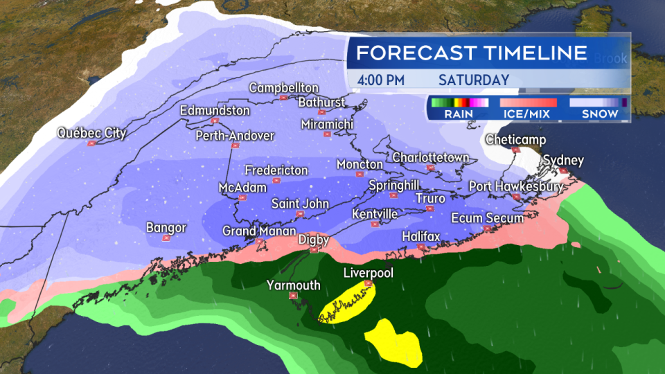
Snow, heavy for some, develops Saturday morning and afternoon. Mixing in of ice pellets/rain looks likely for parts of Atlantic coastal NS and the southwest of that province.
The mixed precipitation will lead to highly varied accumulation on and near the Atlantic coastline of Nova Scotia. In the Halifax area, for example, it could easily be an event in which 5 to 15 cm of snow/ice pellets is seen for the area stretching from Sambro and the Eastern Passage to the city centres of Halifax and Dartmouth. Moving to and inland of Bedford, the snow could jump into the 15 to 25 cm range if less ice pellets are present. Best to be prepared to see a minimum of 15 cm.
The northern edge of the heaviest snow could extend into southern New Brunswick and eastern parts of Prince Edward Island. Pockets of higher snowfall amounts in excess of 25 cm have been indicated by guidance for northern and eastern areas of Nova Scotia. I should note that the system is nearly 48 hours out and there has been some shift north and south for the area of higher snow between various computer models.
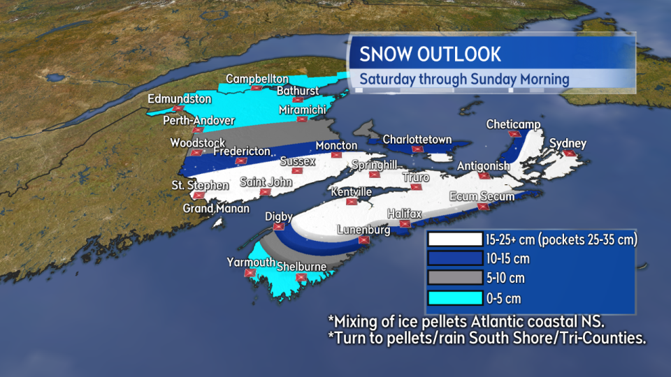
The most widespread heavy snow has been indicated in a region stretching from southern New Brunswick into central, northern, and eastern Nova Scotia. Parts of eastern PEI could also catch some heavier bands as the system moves through.
The system will continue to strengthen as it moves past, so gusty winds will accompany the precipitation. East and northeast winds could build to widespread gusts 30 to 60 km/h Saturday afternoon and evening. Gusts peak near 70 km/h on the Atlantic coastline of Nova Scotia. The wind turns northerly overnight and diminishes into Sunday morning. Periods of blowing and drifting snow reducing visibility should be expected.
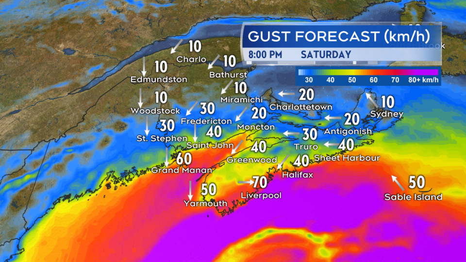
Gusty east and northeast winds develop through Saturday. Watch for reduced visibility in blowing snow. The wind turns north and diminished overnight into Sunday morning.
Since we are still a few days out and the system is one that will rapidly develop near Cape Cod before moving through, there is time to see change in the local details of the forecast. I highly recommend to continue to check on any weather alerts issued for your area by Environment Canada heading into Saturday.


