As we head towards the spring equinox (March 20th) it seems like a good time to look back at the past winter season and gauge how we finished for temperatures and snow.
Let's start with temperatures.
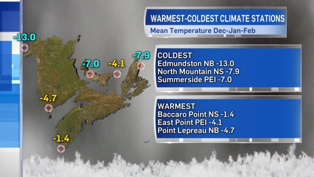
After evaluating the data from climate stations that report at the end of each month, the coldest areas on average for the Maritimes (December through February) are where you'd expect them to be -- mainly in northern and western areas most exposed to outbreaks of cold air off the continent and away from heavy marine influence. Likewise, those areas that finished milder are locations further south and located closer to the moderating effects of a marine climate.
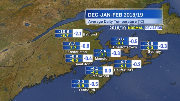
Was the season colder or warmer than normal? Mostly colder, with the greatest deviation from 30-year climate normals (an average taken over 30 years) in northern areas of New Brunswick. This, again, is part of the region that would be most exposed to Arctic-sourced air through the season. We did get into cold snaps early last year. November and December were well below normal, which may be why this past season dragged on colder for longer, more than the December-through-February averages tell.
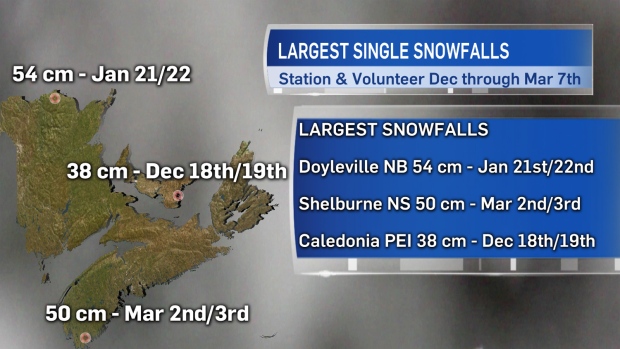
It was a boom-and-bust year for snow in the region, but when the snow boomed it produced some impressive totals! Interestingly, each province recorded its largest single snowfall in a different month this year.
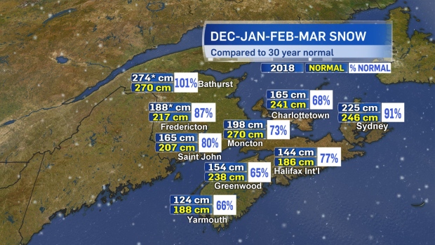
As we know, here in the Maritimes, we can still pick up a significant amount of snow through March. The month isn't over yet, but here is a comparison of where several sites stand with total snow December through March, compared to normal. Areas designated with an * are from volunteer reports through the season.
Snowfall was generally near or above normal for New Brunswick and generally lower than normal for most of Prince Edward Island and Nova Scotia. Those areas finishing shy on snowfall certainly made up for it in contending with some very icy periods of weather.
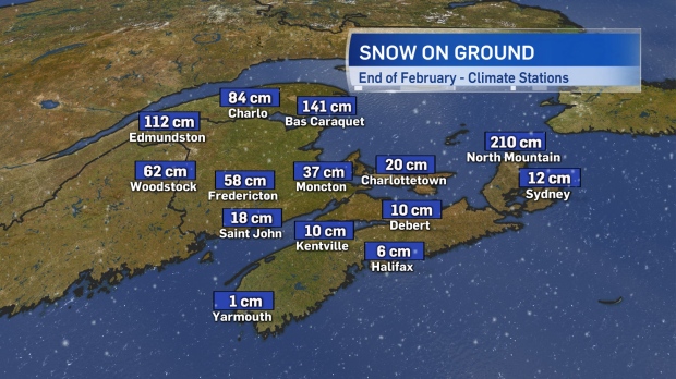
As interesting as it is to look at total snowfall through the season, in some regards, snow-on-ground through the winter is more important. With much higher snow-on-ground present at the end of February for central and northern areas of New Brunswick, the spring period will need to be monitored closely as all that stored water eventually enters the river system. This is a component to assessing risk for spring flooding. The lack of snow cover in areas of the Maritimes (particularly Nova Scotia) also leads to problems through the season as snow can act as an insulator. Without much snow cover, some areas experienced increased freezing of water and septic lines.

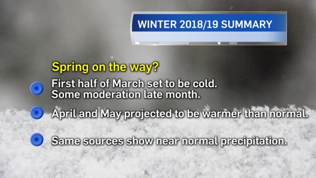
How about a quick look ahead to spring? March is likely to finish colder than normal. While we are almost through the coldest of the air expected this month, there is expected to be two more less-intense rounds of colder air -- a brief one on the 12th into 13th and one that may extend a few to several days arriving near the 18th. Following that, a number of climate models point to above-normal temperatures April and May when averaged out. Those same sources are calling for near normal amounts of precipitation through the spring period.