
After an early named storm, Andrea, that developed on May 20, the start to the Atlantic Hurricane season has been quiet.
That looks like it may change within the next few days.
A weak area of low pressure is sinking south out of eastern Florida towards the Gulf of Mexico. As the low enters the Gulf it will provide structure and rotation to a broad area of thunderstorms that have been increasing in strength and frequency over the last few days. Once those thunderstorms start to rotate and organize around the centre of low pressure, the result may be a tropical cyclone (a class of storm systems that includes tropical depressions, storms, and hurricanes) at which point it would be named Barry.
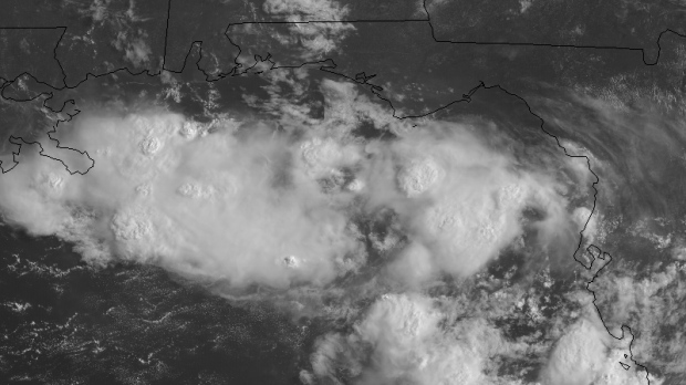
NASA satellite imagery showing an increased amount of thunderstorm activity in the Gulf of Mexico. Thunderstorm tops are the “bubbled” textured portion of the clouds.
The waters in the Gulf of Mexico are warm enough to support further strengthening as they sit in the low 30s – well above the 26.5 C temperature needed to fuel a tropical system.
Winds will play a key role as well. If winds are too sheared (too much change in direction and speed with height) it would act to prevent the potential storm from becoming organized. Regardless, due to the heavy moisture content in the occurring thunderstorms, authorities along the coasts of the Gulf states will need to monitor the weather conditions closely as heavy rain will be a threat. The Weather Prediction Center of the NOAA has outlooks showing the possibility of rainfall amounts exceeding 100 mm for coastal areas of Alabama, Mississippi, Louisiana, and Texas by the end of the weekend, though largely dependent on the development and path of the system which isn’t completely known yet.
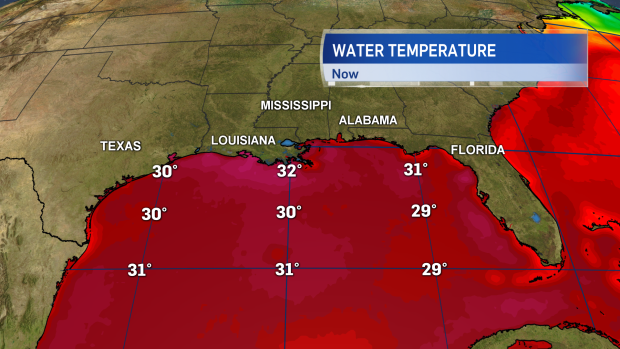
Gulf of Mexico sea surface temperatures are mostly in the low 30’s, which is near normal for this time of the year. Warm enough to support the strengthening of a tropical system.
It’s too early to tell if there will be any eventual impact to the Maritimes. Over the next several days, the primary risk is to the Gulf States. However, should the system come back inland to North America, it is possible that sometime next week remaining moisture or rain could get tied up in a weather system that would head our way. It wouldn’t be structured as an organized tropical system at that point.
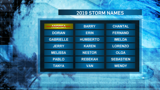
The list of names for the 2019 Atlantic Hurricane Season. Andrea formed early and outside of the start of the season. Barry may develop within the next few days.


