
HALIFAX -- There were dramatic skies and weather in the form of thunderstorms on Monday and Tuesday.
Many fantastic pictures and videos of that weather came into the CTV Atlantic Weather Centre. Here are some of those pictures and a brief explanation of what is at work in them.
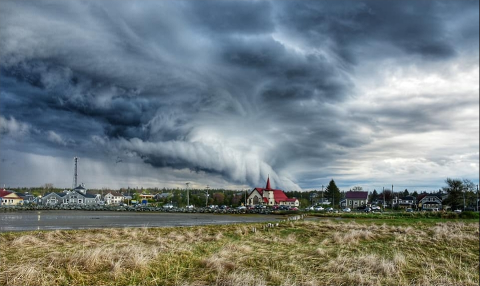
Shelf (Arcus) Cloud
The bulk of the storm pictures I received were of a very ominous-looking cloud formation known as a shelf cloud. A shelf cloud falls under the family of arcus clouds in meteorology.
They frequently form along the leading edge of the gust front associated with a thunderstorm. Characteristics of the cloud are a smoothed and arcing appearance, with the exception of the bottom of the cloud being more ragged.
The cousin of the shelf cloud is the roll cloud, which is a long, tube-shaped cloud formation often associated with a passing weather front. I most often receive roll cloud pictures from fishermen in our marine areas as a cold front passes through.
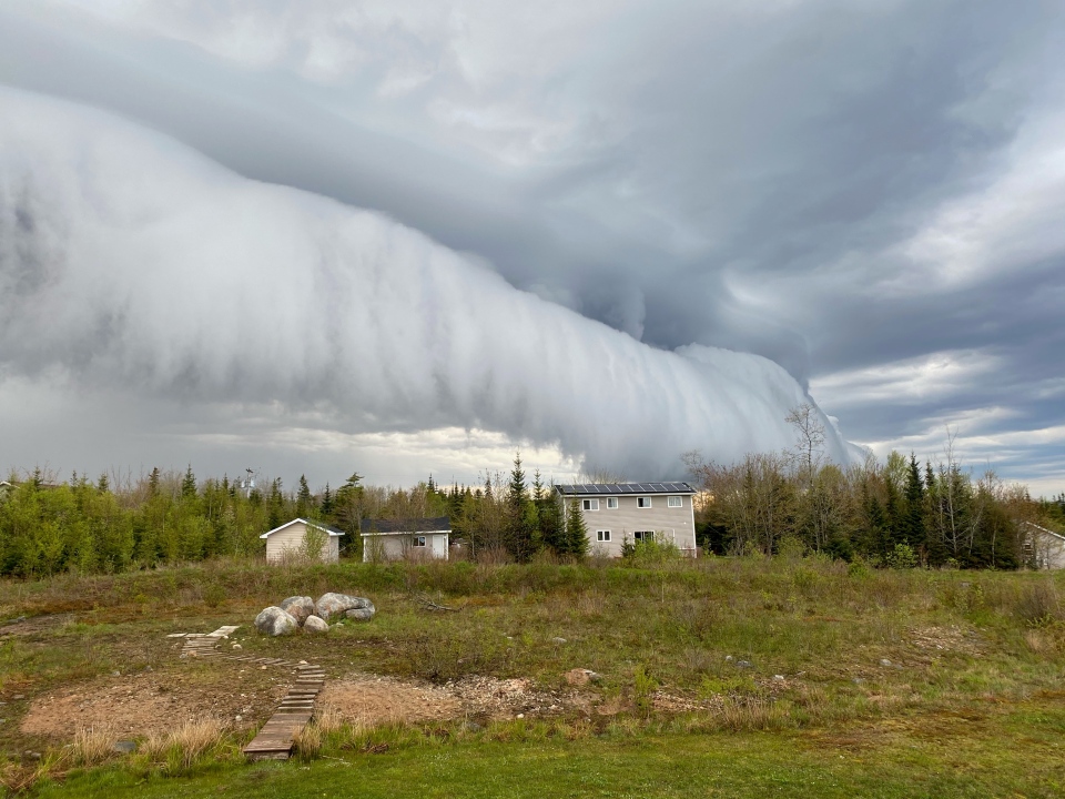
A shelf cloud passing through Porters Lake, NS on Tuesday by Vicky MacKenzie.
Mammatus Cloud
Mammatus, meaning udder or breast in Latin, is a cloud formation that takes the appearance of a bubbly cluster. While developed out of the instability inherent in thunderstorm activity, they do not necessarily herald the arrival of severe weather conditions themselves.
There are several theorized mechanisms of how the cloud formation may develop, but the distinctively smooth, lumpy bottoms are created by pockets of sinking cooler air.
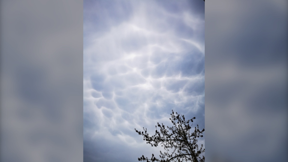 Mammatus clouds seen near Hubley NS but Matthew Croft on Monday.
Scud (Pannus) Cloud
Scud clouds are smaller, ragged pieces of cloud that are created by the warmer updrafts of a thunderstorm. Warm, moist air near the surface is lifted aloft and condenses into the cloud which is then pushed away from the thunderstorm.
Due to being located underneath the main body of the thunderstorm and sometimes having a rope-like appearance, they are often mistaken for a tornado or funnel cloud. A keen observer will note that they lack the intense rotation that a tornado or funnel cloud has.
 Ragged, filaments of scud cloud seen underneath the thunderstorm passing through Eastern Passage NS in this picture taken by Debbie O’Reilly-Smith.
Cumulonimbus Cloud
A heavy, moisture laden cloud that has a relatively low base but towers up high into the atmosphere. These are our thunderstorms. They develop in an atmospheric environment that is favourable for the movement of warm, moist air at the surface into cooler, drier air aloft.
This creates the strong updrafts and downdrafts that comprise the thunderstorm. The more moisture and instability the storms have to work with, the stronger they can become. Sometimes they will need a trigger, such as a passing cold front, to get the development started.
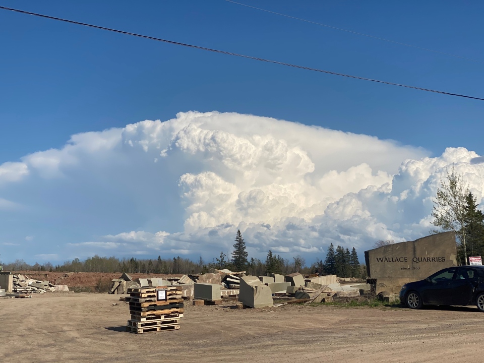
A towering cumulonimbus cloud over Pictou County, NS as seen from Wallace by Tom Flynn. The thunderstorms produced a significant, long duration hail event for parts of the county.
Lightning
As a cumulonimbus cloud develops the turbulent updrafts and downdrafts within it jostle together ice crystals and frozen water droplets. This builds a static electric charge within the cloud with the top of the cloud becoming positively charged, and the bottom negatively charged.
The charge is then equalized with the electrostatic discharge we know as lightning. Lightning can occur cloud-to-cloud, cloud-to-ground, or intra-cloud. The lightning bolt can have either a negative or positive charge.
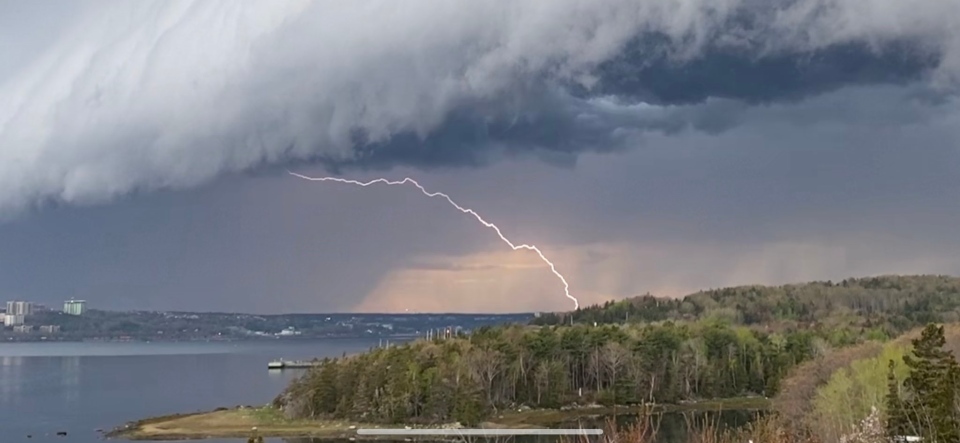
Lightning caught in a picture by Margaret Gray of Bedford NS on Tuesday.
Hail
Hail starts as water droplets lifted up in the strong updraft of a developing thunderstorm. As it enters air aloft in the atmosphere with temperatures below zero, the water droplet freezes solid.
A hailstone can continue to grow in size by contacting other droplets of super cooled water or even stick together with another hailstone as a result of a collision. When large enough, the force of gravity will overcome the updraft and the hail will fall to the surface. Hail large enough to cause damage is relatively rare in the Maritimes. Hail with a diameter of two centimetres or more is cause for a severe thunderstorm warning to be issued.
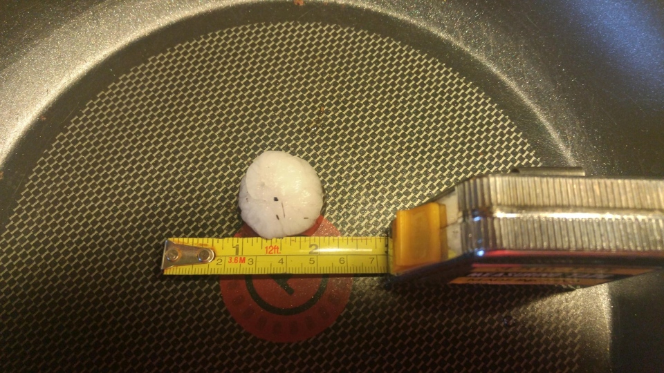
Hail with a diameter of near 2 cm was measure by Troy Lees near Central West River, NS on Monday. This size of a hailstone is relatively rare in the Maritimes as some damage to vegetation and property was reported during the event.
Rainbow and Double Rainbow
The presence of a thunderstorm often puts many water droplets into the air. Sunlight is reflected, refracted, and dispersed by these water droplets resulting in the appearance of a rainbow. A double rainbow occurs as light is reflected twice within the water droplet before exiting. The colours of the second rainbow arc are reversed.
 A double rainbow spotted following the Tuesday thunderstorm in Halifax NS by Randy Moore.


