
HALIFAX -- So far, it is has been an unusually warm winter in the Maritime region, but the area isn’t done with cold temperatures quite yet.
After Sunday’s winter storm, the Maritimes now have some polar-sourced air bringing a bitter cold to the region, that is expected to stick around for at least several days.
Before we bundle up for a February freeze, lets take a look back at January, a month that saw above seasonable temperatures and lower than usual snowfall. Here’s some information for the month of January from Environment and Climate Change Canada.
The Maritime region finished January, with temperatures about two to six degrees warmer than climate normals. The greatest departures in areas of New Brunswick where at least 20 observation sites reported within the top five of warmest average daily January temperature on records.
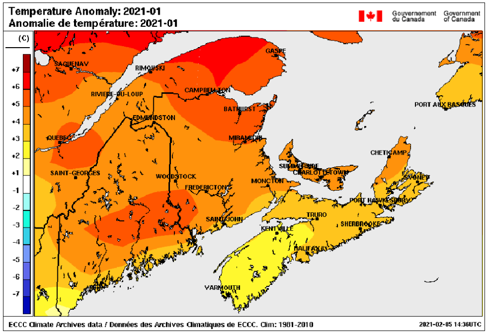
Regional analysis of departure of average daily temperature for January 2021, compared to 30 year climate normal. (Environment and Climate Change Canada)
Total January precipitation was found to be below normal for most of the region with the exception of some central areas of Nova Scotia. Fredericton, N.B. reported its ninth driest January on record and Yarmouth N.S. saw its fifth driest January.
Combined with the milder temperatures, it’s no surprise that January snow was down significantly compared to the 30 year normal. It is estimated that large parts of the Maritimes saw only a quarter to half of typical January snowfall.
Saint John N.B. reported its sixth least snowy January on record with only 17 cm through the month. The most snow fell in northern areas of New Brunswick, northern/eastern N.S., and the Cape Breton Highlands with area estimates of 40 to 100 cm.
The lack of snow also contributing to many near and zero snow on ground reports by months end.
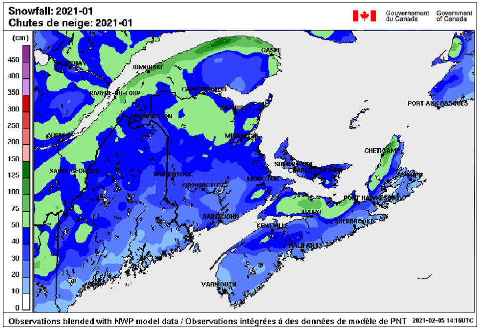
Area estimates of total January snowfall for the Maritimes. The most in northern New Brunswick, northern/eastern Nova Scotia, and the Cape Breton Highlands. (Environment and Climate Change Canada)
The unusually mild weather also had an impact on sea ice around the region. As I noted in January, sea ice development and extent hit record lows for the month.
Ice coverage in the Gulf of St. Lawrence for the final week of January finished at about 1.6 per cent, with the median on record 23.7 per cent. Ice development is estimated to be an entire month behind.
With the snowstorm that just hit Nova Scotia, southern New Brunswick, and Prince Edward Island this past week it won’t take much more snow for many locations to reach February normals.
Environment Canada's monthly prediction for February is for the month to finish with near normal temperature and precipitation.
The spell of colder temperatures we are now into will also work to bring this month a more traditional winter feel that January.
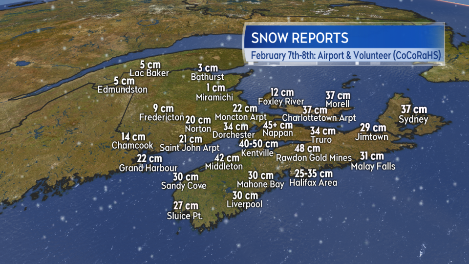
Snow total reports from the winter storm that hit the Maritimes February 7 to 8. The single event has brought parts of N.S., southern N.B., and P.E.I. close to February snowfall averages. (Environment and Climate Change Canada)
Data and maps provided by Environment and Climate Change Canada.


