HALIFAX -- Hurricane Teddy is a large Category 3 hurricane with maximum sustained winds near 195 km/h.
The storm is forecast to pass just east of Bermuda on Sunday as a Category 2 hurricane. While a direct landfall in Bermuda looks unlikely, tropical storm conditions are still expected for the island, and a Tropical Storm Warning is in effect.
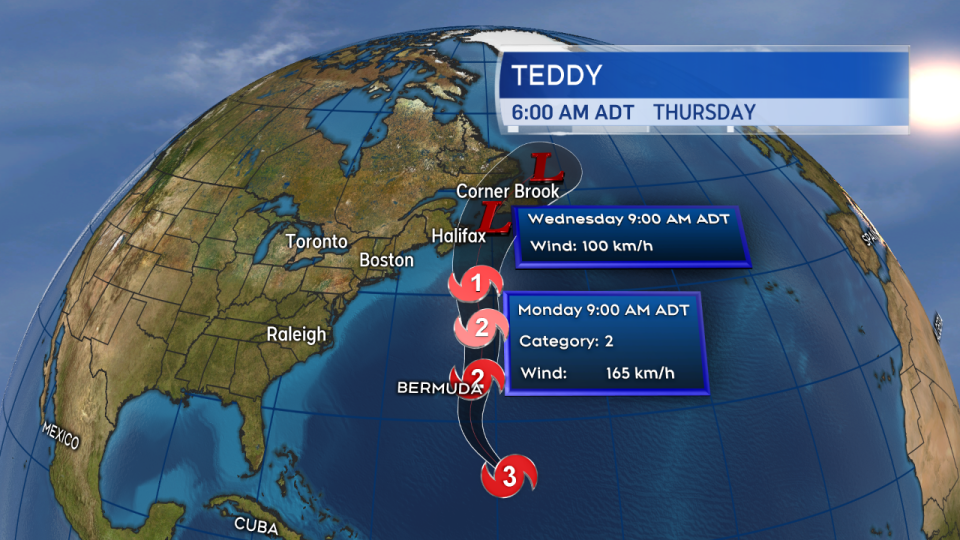
Hurricane Teddy passes east of Bermuda late Sunday before making an approach towards Atlantic Canada.
Teddy is forecast to arrive in the southern marine areas of the Maritimes as a Category 2 or Category 1 hurricane Tuesday morning.
As it approaches the eastern Atlantic coastline of Nova Scotia, the storm will undergo post-tropical transition. Post-tropical storm Teddy will then take a path somewhere between eastern Nova Scotia and central Newfoundland before entering north Atlantic ocean waters. This is a trend towards the more eastern portion of the forecast cone issued by the National Hurricane Center over the past few days.
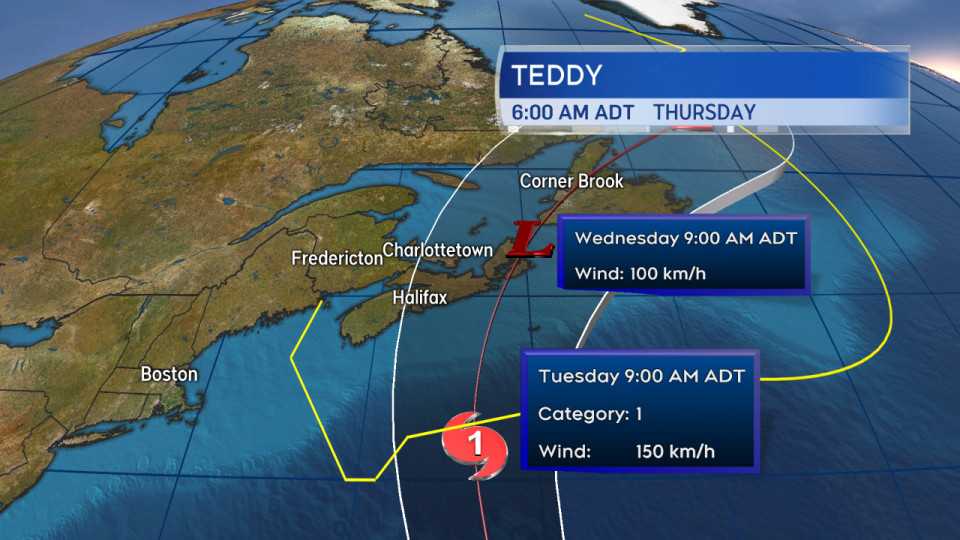
Teddy enters the southern marine areas of the Maritimes Tuesday morning, becoming a post-tropical storm as it passes through our region.
Despite a post-tropical transition in the forecast, a large portion of the Maritimes remains at risk of a period of tropical storm force wind. That would be a one-minute sustained wind of 63+ km/h with stronger gusts.
The area at greatest risk is currently forecast to be Lunenburg County and east in N.S., P.E.I. and southeastern N.B. The most likely arrival time of the stronger winds is being given as Tuesday afternoon and evening.
Given gusts, tree foliage, and heavy rain, there is a risk of power outages with that wind. A period of stronger wind is also likely Tuesday night and Wednesday in the wake of the departing storm.
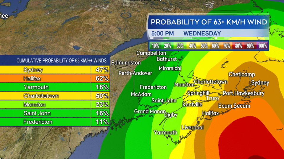
The storm will have a large field of strong winds as it moves through. A large portion of Nova Scotia and PEI are still forecast to be at risk of tropical storm-force winds.
A storm packing as much moisture as Teddy will bring heavy rain with it. Pockets of 50 to 100+ mm of rain are a risk for the region.
While it is too early to narrow that down to specific regions, the general area of risk would again be Lunenburg Co and east in N.S., P.E.I. and southeastern N.B.
The storm may bring significant wave heights of 12 to 15 metres into the marine area of the Maritimes.
The WaveWatch III model run by the NOAA also shows potential 6 to 8-metre waves near Atlantic coastal Nova Scotia late Tuesday. The Canadian Hurricane Centre has stated that storm surge is possible, mainly for parts of Nova Scotia, Prince Edward Island, Magdalen Islands and Newfoundland. Still, it is too early to be specific about which portions of the coastline may be affected.
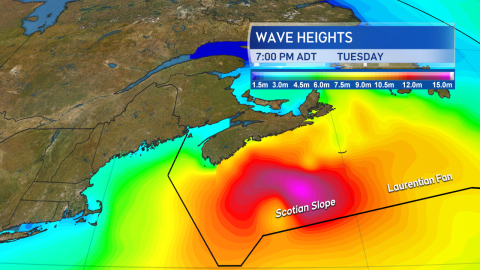
Large waves will be brought in by the storm to the marine districts of the Maritimes as well as near the coastline. Details of the risk of storm surge are still to be determined.
Both the Canadian Hurricane Centre and the National Hurricane Center will continue to post multiple daily updates on Teddy. Monitor your forecast, make appropriate preparations, and watch for weather warnings or alerts issued for your area.


