A strengthening low-pressure system will move up from the coastline of New England across the Maritimes on Wednesday.
The storm will have both a colder, snowy side and rainy, windy side to it. Northern and western areas of New Brunswick will end up on the snowy side of the inclement weather as it moves through.
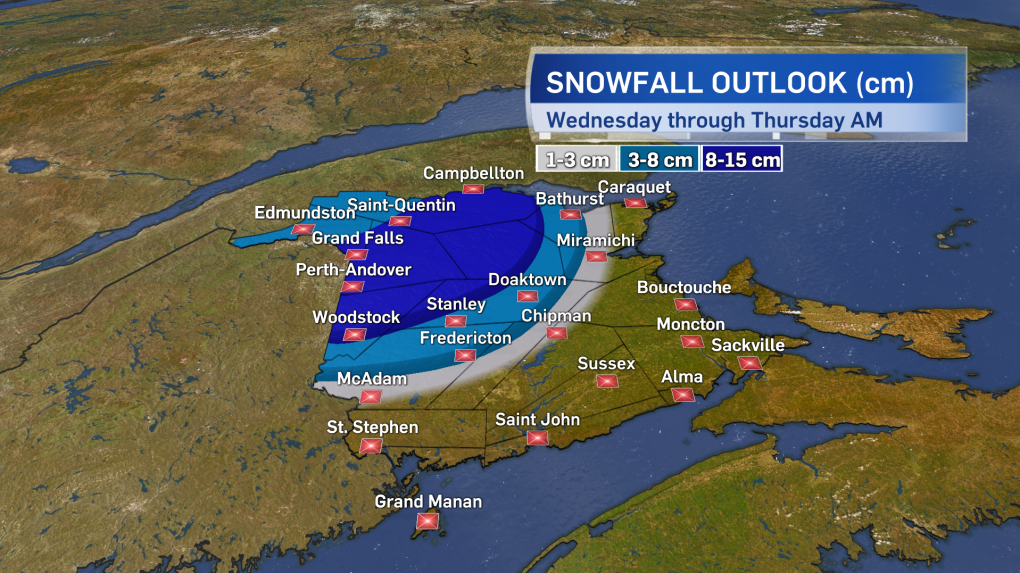
Rain and elevation will impact how much snow collects, but a large area of the province along and west of a line from Woodstock to Bathurst could see snow totals of 8 to 15 cm Wednesday through Thursday morning. The Fredericton area could see a few to several slushy centimetres.
Other areas of New Brunswick may see some wet snow, but mostly rain that will total 10 to 20 mm.
A special weather statement issued by Environment and Climate Change Canada remains in effect for the northwestern half of the province because of the early season snowfall.
For Prince Edward Island and Nova Scotia, this is a rain and wind event. General rainfall amounts of 15 to 30 mm are expected with local amounts 40 to 60 mm in eastern Nova Scotia including Cape Breton.
A series of rainfall warnings and special weather statements has been issued for that part of the province. East and southeast winds will increase tonight to include widespread gusts of 40 to 70 km/h.
Some gusts will approach 80 km/h for Cape Breton and P.E.I. Due to the topography of the Highlands, gusts for northern Inverness County may peak close to 100 km/h and a Les Suetes wind warning has been issued for that area. The Confederation Bridge has issued an advisory that restrictions may be required for bridge travel on Wednesday.
