Kalin’s Call: Weather front brings risk of freeze on Friday
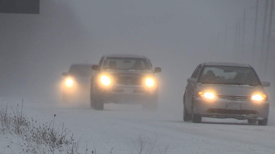 File image. (CTV News Atlantic)
A strong cold front and a low pressure system out of the midwestern U.S. will cross the Maritimes from west-to-east Thursday evening into Friday evening.
The combination will bring heavy snow and rain as well as strong southwest winds to parts of the region. A quick drop below freezing will bring the risk of icy surfaces developing Friday afternoon and evening.
 A combination of weather front and low pressure system cross the Maritimes on Friday.
The first part of this system will build Thursday, bringing patchy showers, drizzle, and fog, along with milder temperatures to the Maritimes.
Thursday night will see rain turn to snow for northern areas of New Brunswick, creating periods of ice pellets and freezing rain in between.
Rain, at times heavy, is expected for the rest of the Maritimes Friday morning and afternoon. As the front crosses, mild temperatures will quickly fall below the freezing mark in as little as an hour or two. This means that untreated surfaces could get icy quickly. The fall in temperatures may also be accompanied by a period of lighter wintry weather that includes ice pellets and snow.
Parts of the Maritimes that experience steadier rain should watch for localized flooding, as drains may be blocked, and melting snow and ice could create additional water.
 Most areas start as rainy, windy weather. A quicker turn to snow and more accumulation in it expected for northern New Brunswick. The entire region will need to watch for icy surfaces Friday afternoon and evening with a quick drop in temperatures.
A southwest wind will pick up Wednesday night into Thursday morning, meaning widespread gusts of 40 to 70 km/h are likely on Thursday. The Tantramar Marsh area, spanning northern Nova Scotia and southeastern New Brunswick, could hit gusts of 80 to 100 km/h.
Northern Inverness County in Cape Breton could also be at risk of seeing gusts near or in excess of 100 km/h due to the topography of the Highlands.
A peak in southwest winds is likely Friday morning and afternoon, just ahead of the passage of the front. During that time, peak gusts may reach 80 to 100 km/h for parts of southern New Brunswick, Prince Edward Island, and Nova Scotia. Gusts in northern Inverness County could reach or exceed 130 km/h.
Friday evening will see wind turn to the northwest of the region, with the wind diminishing into Saturday morning. Winds that high typically come with a risk of power outages.
 High winds gusts from the southwest are expected Thursday reaching a peak Friday morning and early afternoon. A wind such as this typically come with a risk of power outages.
Wind warnings have already been issued for Nova Scotia's Cumberland County and southeastern New Brunswick. A special weather statement has been issued for the entirety of the Maritimes, citing the heavy precipitation, high winds, and rapid fall in temperatures.
The public is advised to monitor the forecast and any further weather alerts. I’ll have updates here and on CTV Atlantic News at Noon, 5 p.m., 6 p.m., and 11:30 p.m.
CTVNews.ca Top Stories

DEVELOPING Slovakia's populist prime minister shot in assassination attempt, shocking Europe before elections
The Slovak defence minister says doctors are fighting for the life of the country's prime minister, who was shot multiple times after a political event Wednesday afternoon.
Transport Canada's UFO 'lead' planned to meet with U.S. intel officials, called info requests a 'wild goose chase'
Canada's transportation department had a UFO 'lead' who tried to 'quell' media interest and planned to meet with U.S. intelligence officials.
'Very expensive lunch': Sask. driver handed a cell phone ticket for using points app in McDonald's drive-thru
A warning from a Saskatoon driver about using your fast-food app while in the drive-thru line — a trip to get some free lunch cost him a lot more than he bargained for.
'The Fly' has become notorious in France after a brazen escape. What's his criminal history?
A prisoner nicknamed “The Fly” has become notorious in France overnight after a daring and bloody escape from a prison convoy in Normandy that left two guards dead.
BREAKING Ontario's 'Crypto King' Aiden Pleterski arrested
Aiden Pleterski, the self-proclaimed 'crypto king' from Whitby, Ont., has been arrested in Durham Region after allegedly running a Ponzi scheme worth more than $40 million.
Barge hits a bridge in Texas, damaging the structure and causing an oil spill
A barge slammed into a bridge pillar in Galveston, Texas, on Wednesday, spilling oil into surrounding waters and closing the only road to a smaller and separate island that is home to a university, officials said. There were no immediate reports of injuries.
Person responsible for 1996 drugging of 'Titanic' crew likely not a local: Halifax police
Halifax Regional Police believe a non-resident could be responsible for the infamous drugging of numerous crew members of the 'Titanic' movie with a hallucinogenic in 1996.
Latest updates on the biggest wildfires burning in Canada
Thousands of people in Western Canada remain displaced from their homes as wildfires threaten their communities, triggering evacuation orders and alerts.
OPINION If you think you can’t focus for long, you’re right: Sandee LaMotte
Regaining your focus requires you to be mindful of how you are using technology -- a daunting task if you consider the average American spends at least 10 hours a day on screens.


